
Atlantic Hurricane Outlook – July 21, 2025: Tropics Active with Waves, But No Imminent Threats

The tropical Atlantic is becoming increasingly active, with multiple tropical waves progressing westward across the basin. While none are expected to develop in the short term, the setup is a reminder that we are entering a more climatologically favorable period for storm formation.
Satellite imagery courtesy of Windy.com
Atlantic Basin Overview: No Cyclones, But Multiple Waves
As of the 8:00 AM EDT update from the National Hurricane Center:
No active tropical cyclones
No systems with high development potential at this time
Disturbance 1: A tropical wave near 40°W is producing scattered convection, but environmental conditions remain only marginally favorable.
Formation chance (7 days): 20%
Movement: West to west-northwest at 10–15 mph
New Wave Introduced: A second tropical wave near 23°W, just offshore of Africa, is showing scattered moderate convection on its southern flank.
Too early to determine development potential, but it will be watched over the coming days.
Monsoon Trough Low: A weak low embedded along the monsoon trough near 08N44W is sparking convection, but not currently organized.
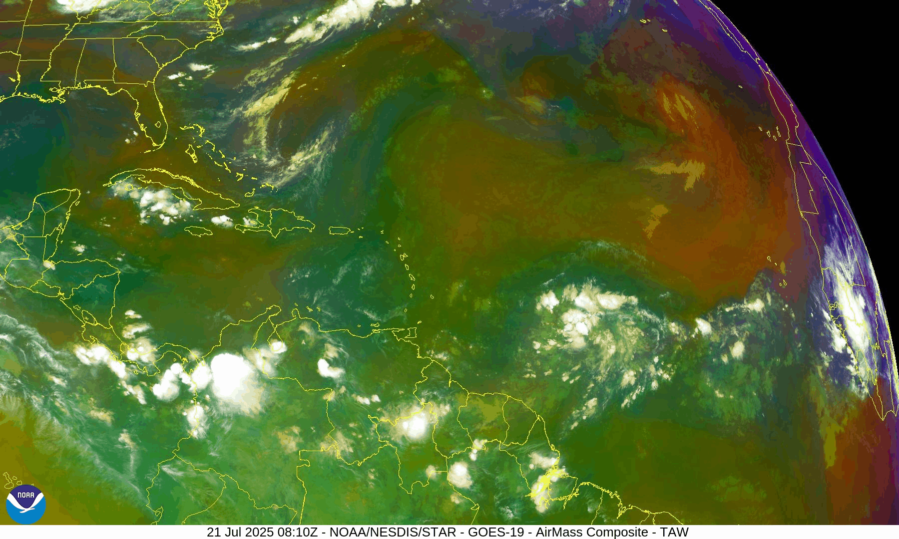
NOAA/NESDIS/STAR – GOES-19 Air Mass Composite – July 21, 2025
Sea Surface Temperatures (SSTs): Still Warm
Gulf of Mexico: 86–88°F – well above average
Western Caribbean: 85–87°F – supportive of development
Main Development Region (MDR): 82–84°F and climbing, with warm anomalies persisting
Warm waters throughout the basin provide the necessary energy for storms should other conditions align.
Sea Surface Temperature data courtesy of Windy.com
Wind Shear and Atmospheric Conditions

Wind Shear Courtesy of https://tropic.ssec.wisc.edu/
Shear remains moderate across much of the central and eastern Atlantic but is expected to weaken later in the week.
Moisture levels continue rising, particularly in the MDR and Caribbean.
Saharan Air Layer (SAL): Still present but beginning to thin slightly, particularly west of 40°W.
These factors collectively suggest improving potential for storm development by late July or early August.
Relative Humidity (ECMWF) data courtesy of Windy.com
Saharan Air Layer (Dust) data courtesy of Windy.com
Gulf of Mexico & Caribbean Outlook
A surface trough remains in the eastern Bay of Campeche, producing scattered thunderstorms.
Light to moderate winds (10–15 kt) dominate much of the Gulf, with seas around 3–5 feet.
Fresh winds (15–20 kt) and higher seas (6–8 ft) continue across parts of the south-central Caribbean.
Expect stronger trades and more convection near the Windward Passage and central Caribbean midweek as a tropical wave enters the region.
Wave height forecast (ECMWF Waves) courtesy of Windy.com
Surface pressure data (ECMWF) courtesy of Windy.com
Florida Forecast
Highs: Upper 80s to low 90s°F
Humidity: High
Rain Chances: Scattered afternoon thunderstorms, driven by sea breezes and instability
Winds: Light and variable, turning southeast near the coast
Hazards: Isolated strong storms possible with gusty winds and localized flooding
Rainfall forecast (ECMWF) courtesy of Windy.com
Prep Tip of the Day: Update Insurance and Inventory
Use this lull to get your disaster documentation in order:
Review your homeowners or renters insurance policy
Document your belongings via photos or video
Store digital backups in the cloud
Know your flood zone and verify your flood insurance coverage
Looking Ahead: Tropics Warming Up
While no tropical cyclone development is expected in the next 7 days, the overall pattern is becoming more favorable. Multiple waves in the deep tropics bear watching, and model guidance hints at potential activity in early August. We'll continue monitoring all waves for signs of organization.
Stay informed, stay prepared, and check back daily for updates from Cat5Prep.com.