

Atlantic Hurricane Outlook – July 21, 2025: Tropics Active with Waves, But No Imminent Threats
The Atlantic remains cyclone-free, but several tropical waves are moving across the basin. Conditions are gradually becoming more favorable for development as July progresses.
The tropical Atlantic is becoming increasingly active, with multiple tropical waves progressing westward across the basin. While none are expected to develop in the short term, the setup is a reminder that we are entering a more climatologically favorable period for storm formation.
Satellite imagery courtesy of Windy.com
Atlantic Basin Overview: No Cyclones, But Multiple Waves
As of the 8:00 AM EDT update from the National Hurricane Center:
No active tropical cyclones
No systems with high development potential at this time
Disturbance 1: A tropical wave near 40°W is producing scattered convection, but environmental conditions remain only marginally favorable.
Formation chance (7 days): 20%
Movement: West to west-northwest at 10–15 mph
New Wave Introduced: A second tropical wave near 23°W, just offshore of Africa, is showing scattered moderate convection on its southern flank.
Too early to determine development potential, but it will be watched over the coming days.
Monsoon Trough Low: A weak low embedded along the monsoon trough near 08N44W is sparking convection, but not currently organized.
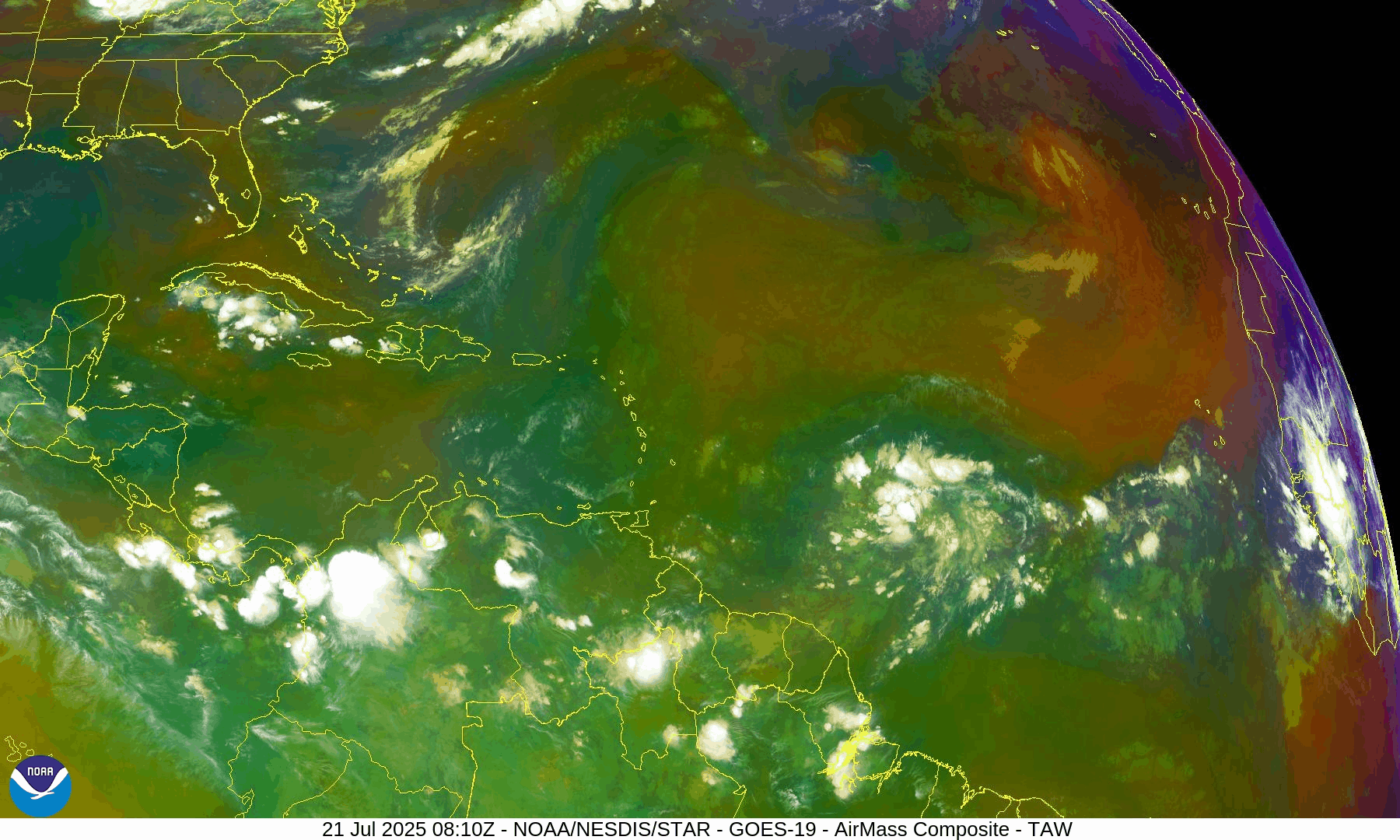
NOAA/NESDIS/STAR – GOES-19 Air Mass Composite – July 21, 2025
Sea Surface Temperatures (SSTs): Still Warm
Gulf of Mexico: 86–88°F – well above average
Western Caribbean: 85–87°F – supportive of development
Main Development Region (MDR): 82–84°F and climbing, with warm anomalies persisting
Warm waters throughout the basin provide the necessary energy for storms should other conditions align.
Sea Surface Temperature data courtesy of Windy.com
Wind Shear and Atmospheric Conditions

Wind Shear Courtesy of https://tropic.ssec.wisc.edu/
Shear remains moderate across much of the central and eastern Atlantic but is expected to weaken later in the week.
Moisture levels continue rising, particularly in the MDR and Caribbean.
Saharan Air Layer (SAL): Still present but beginning to thin slightly, particularly west of 40°W.
These factors collectively suggest improving potential for storm development by late July or early August.
Relative Humidity (ECMWF) data courtesy of Windy.com
Saharan Air Layer (Dust) data courtesy of Windy.com
Gulf of Mexico & Caribbean Outlook
A surface trough remains in the eastern Bay of Campeche, producing scattered thunderstorms.
Light to moderate winds (10–15 kt) dominate much of the Gulf, with seas around 3–5 feet.
Fresh winds (15–20 kt) and higher seas (6–8 ft) continue across parts of the south-central Caribbean.
Expect stronger trades and more convection near the Windward Passage and central Caribbean midweek as a tropical wave enters the region.
Wave height forecast (ECMWF Waves) courtesy of Windy.com
Surface pressure data (ECMWF) courtesy of Windy.com
Florida Forecast
Highs: Upper 80s to low 90s°F
Humidity: High
Rain Chances: Scattered afternoon thunderstorms, driven by sea breezes and instability
Winds: Light and variable, turning southeast near the coast
Hazards: Isolated strong storms possible with gusty winds and localized flooding
Rainfall forecast (ECMWF) courtesy of Windy.com
Prep Tip of the Day: Update Insurance and Inventory
Use this lull to get your disaster documentation in order:
Review your homeowners or renters insurance policy
Document your belongings via photos or video
Store digital backups in the cloud
Know your flood zone and verify your flood insurance coverage
Looking Ahead: Tropics Warming Up
While no tropical cyclone development is expected in the next 7 days, the overall pattern is becoming more favorable. Multiple waves in the deep tropics bear watching, and model guidance hints at potential activity in early August. We'll continue monitoring all waves for signs of organization.
Stay informed, stay prepared, and check back daily for updates from Cat5Prep.com.

Atlantic Hurricane Outlook – July 20, 2025: Tropical Wave Parade Signals a Shifting Pattern
Multiple tropical waves are moving across the Atlantic, including a monitored disturbance near 40°W and a new wave off the African coast. While no tropical cyclones are active, conditions are being closely watched for signs of development.
As we close out the third week of July, the Atlantic remains without named storms—but activity is clearly on the upswing. Multiple tropical waves stretch across the basin, including a disturbance in the central Atlantic, a new wave off Africa, and a low near 08N44W. While none are close to development yet, we are seeing textbook signs of a transitioning pattern that could prime the Atlantic for August’s ramp-up.
Atlantic Basin: Watching Several Waves
As of the 8:00 AM EDT Tropical Weather Outlook and 0600 UTC Surface Analysis:
No active tropical cyclones
One area of interest with low development chances (20%): A tropical wave near 40°W continues to be monitored.
New tropical wave introduced: Near 23°W in the far eastern Atlantic (off Africa), moving westward with convection along its southern flank.
Low pressure near 08N44W embedded in the monsoon trough is helping spark convection.
Disturbance 1, the central Atlantic wave, continues to move westward at 10–15 knots. While still disorganized, it maintains scattered convection and remains under close watch. Other waves in the deep tropics—including the new one off Africa—will be tracked for organization over the coming week.
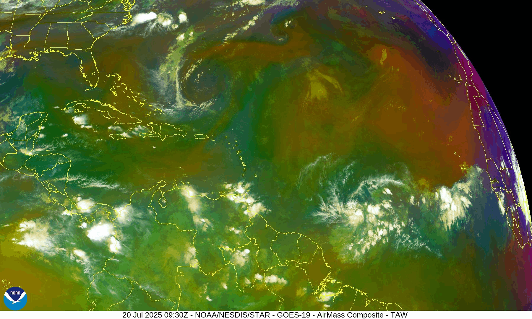
NOAA/NESDIS/STAR – GOES-19 Air Mass Composite – July 20, 2025
Sea Surface Temperatures: Warm and Welcoming
Ocean heat content remains very favorable:
Gulf of Mexico: 86–89°F (30–32°C)
Western Caribbean: Holding steady at 86°F+
Main Development Region (MDR): Near-to-above normal, especially between 30W and 50W
There is no shortage of storm fuel—the atmosphere just needs to catch up.
Sea Surface Temperature data courtesy of Windy.com
Wind Shear & Moisture: A Gradual Shift
Wind shear remains moderate in the central and western Atlantic, but is forecast to slowly ease.
Dry air from the Saharan Air Layer continues to impede vertical development of tropical waves, especially in the MDR.
Moisture is increasing around the Intertropical Convergence Zone and the Caribbean, a key precursor for storm organization.

Wind Shear Courtesy of https://tropic.ssec.wisc.edu/
Relative Humidity (ECMWF) data courtesy of Windy.com
Saharan Air Layer: Still in Control—for Now
The SAL remains widespread across the eastern and central Atlantic, with effects including:
Dry air entrainment disrupting convective growth
Stronger mid-level winds inhibiting vertical cloud development
This suppression is expected to loosen over the next 7–10 days, coinciding with climatological acceleration.
Saharan Air Layer (Dust) data courtesy of Windy.com
Monsoon Trough & Convection: Activity Percolating
A monsoon trough stretches from western Africa to near 46°W and supports scattered convection, particularly around 08N44W.
The new wave near 23°W is accompanied by moderate convection—early signs of organization.
Another tropical wave has now moved inland over Central America and is now being monitored in the East Pacific.
Satellite imagery courtesy of Windy.com
Gulf of Mexico: Typical July Pattern, But Shifts Ahead
A surface trough over the Bay of Campeche is causing showers and thunderstorms in the far southwestern Gulf.
Another weak trough across Florida is sparking isolated thunderstorms off the Gulf coast near Naples.
A weak high near the northeast Gulf continues to dominate.
Looking ahead:
Winds could increase by Thursday across the NE Gulf as broad low pressure moves across the southeastern U.S. and possibly into the northern Gulf.
Widespread showers and thunderstorms expected midweek across the east and north-central Gulf waters.
Surface pressure data (ECMWF) courtesy of Windy.com
Caribbean Sea: Breezy and Stormy in the South-Central Basin
Fresh to strong NE to E winds continue in the south-central Caribbean, with seas of 8–11 ft.
Moderate to fresh trades elsewhere with 4–7 ft seas.
Scattered storms noted near Haiti, eastern Cuba, and Panama’s western coast.
A tropical wave expected midweek will bring enhanced shower and thunderstorm activity across the eastern Caribbean and Windward Passage.
Wave height forecast (ECMWF Waves) courtesy of Windy.com
Florida Forecast: Classic Mid-July Conditions
Expect hot and stormy conditions today:
Highs: Around 93°F (34°C)
Humidity: High, with heat index values near 102°F
Storms: Scattered afternoon and evening thunderstorms—non-tropical but locally strong
Winds: Light and variable
Rainfall forecast (ECMWF) courtesy of Windy.com
Prep Tip of the Day: Start Prepping for August, Not Reacting to It
With the tropics on the edge of activity, now’s the time to get ahead:
Replenish your hurricane kit (water, food, medicine, power banks)
Make sure your contact list includes out-of-area family
Stay signed up for emergency alerts in your area
Looking Ahead: Calm Now, But the Tropics Are Flexing
Though no storms are imminent, tropical waves are increasingly active, sea temperatures are peaking, and dry air is slowly loosening its grip.
This is the time to watch, prepare, and not underestimate how quickly conditions can change. Stay with Cat5Prep.com for daily, real-time updates you can trust.