
Atlantic Hurricane Outlook – July 31, 2025: Tropics Active But No Storms on the Horizon
*Those who like data, continue reading. Those it prefer the quick version, jump to the TL;DR here.
The Atlantic basin continues to host several tropical waves—but none are expected to organize into tropical cyclones over the next seven days. Despite warm seas and increasing moisture, wind shear and Saharan dry air maintain a suppressive environment.
Atlantic Basin Summary
As of the 8:00 AM EDT Tropical Weather Outlook (TWO) from the National Hurricane Center, there are:
No active tropical cyclones.
No areas under investigation for development in the next 48 hours or seven days.
The Tropical Weather Discussion (issued at ~12:15 UTC) reveals:
A tropical wave near 43°W (south of 22°N) moving westward at 10–15 kt, with scattered moderate convection between 4–10°N.
Another wave near 55°W (south of 18°N) moving west at about 10 kt, with minimal convection.
These waves are being monitored but show no organized structure or circulation at present.
Key Weather Factors
Sea Surface Temperatures (SSTs):
Across the Gulf of Mexico, Caribbean, and MDR, SSTs range from 29–31 °C (84–88 °F)—values supportive of tropical development if atmospheric conditions improve.
Wind Shear:
Remains moderate to high across most of the Atlantic basin, limiting vertical development of disturbances.
Saharan Air Layer (SAL):
Dry and dusty air persists across the central and eastern Atlantic, suppressing convection in the MDR.
Atmospheric Moisture:
While moisture is gradually increasing near the Caribbean and western tropical Atlantic, the dry air and shear continue to hinder system organization.
Gulf of America (Mexico) & Caribbean Region
No low-pressure areas or disturbances are being tracked.
A dominating high-pressure ridge supports generally light winds and calm seas across the Gulf and Caribbean.
Offshore rainfall remains typical for this time of year—no tropical impacts on the Florida peninsula.
GOES-19 - Sector view: Gulf of America - Sandwich
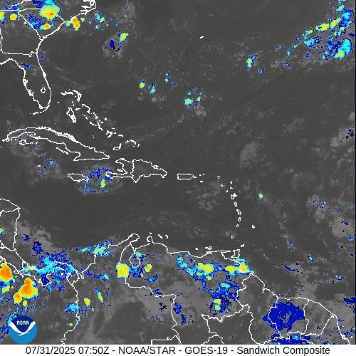
GOES-19 - Sector view: Caribbean - Sandwich
Florida Forecast
High temperatures: Near 90 °F under humid conditions.
Afternoon showers and thunderstorms: 40–50% likelihood due to sea breeze convergence.
Winds: Light and variable inland; east-southeasterly along the coast.
Precipitation: Not driven by tropical systems.
Rain forecast visualization courtesy of Windy.com
Preparation Tip: Review Your Evacuation Plan
Take advantage of the lull to finalize your hurricane readiness:
Verify evacuation zones and travel routes.
Confirm alert registration with local and state emergency systems.
Update contact information and checklist locations with household members.
Outlook & Future Signal
Although today’s conditions remain tranquil, the ongoing wave train emerging from Africa and gradually improving moisture and SST profiles suggest that rainfall and organization potential may increase in early August.
TL;DR – July 31, 2025 Snapshot
No tropical systems present.
Two tropical waves travel west, but show none of the structure needed for development.
Strong wind shear and Saharan dust continue to suppress storm formation.
Warm waters and increased moisture hint at higher activity potential in August.
Stay informed and prepare while the pace allows. Daily updates continue at Cat5Prep.com.