

Atlantic Hurricane Outlook – July 23, 2025: Gulf Disturbance Brings Rain Risk, Tropics Mostly Stable
A low-pressure system in the north-central Gulf is bringing rain to Florida and the northern coast, but development remains unlikely. Multiple waves in the Atlantic are being monitored.
The Atlantic basin remains quiet overall, but a new area of interest has developed in the north-central Gulf of Mexico, with a low (10%) chance of tropical development. Elsewhere, multiple tropical waves continue their westward journey across the Atlantic, but none show signs of immediate organization.
Gulf of Mexico: Watching a Coastal Disturbance
As of the 8:00 AM EDT update from the National Hurricane Center, a trough of low pressure just offshore the southeastern United States is producing disorganized showers and thunderstorms over the north-central Gulf. The system is forecast to drift west-southwestward over the next day or two into more open waters.
Chance of development remains low (10%) as the system will likely move inland before organizing.
Regardless of development, locally heavy rain is expected along the Florida west coast and the northern Gulf coast through the weekend.
We'll continue to monitor this system closely for any signs of improvement in structure.
Satellite imagery courtesy of Windy.com
Atlantic Basin: Multiple Waves Being Tracked
There are no active tropical cyclones, but several waves are being tracked in the deep tropics:
A tropical wave near 40°W continues to produce scattered convection but remains disorganized.
A new wave near 23°W just off the African coast was introduced in this morning’s outlook. It’s producing moderate convection along its southern extent.
A low-pressure feature near 08N44W, embedded within the monsoon trough, is also aiding convection but not expected to develop in the near term.
These features will be watched for signs of improved structure as they move westward.

NOAA/NESDIS/STAR – GOES-19 Air Mass Composite – July 23, 2025
Caribbean & Western Atlantic: Typical July Conditions
Scattered thunderstorms continue near eastern Cuba, Hispaniola, and the southwest Caribbean.
Trade winds remain moderate to fresh across much of the basin.
Seas range from 4 to 8 feet, highest in the south-central Caribbean.
The Saharan Air Layer remains weak to moderate, allowing more moisture into the mid-tropics.
Florida Forecast
Highs: 89–92°F (32–33°C)
Humidity: High, with heat index values over 100°F possible
Rain chances: Elevated this afternoon due to outer moisture from the Gulf disturbance
Winds: Light east-southeast, higher near thunderstorms
Rainfall forecast (ECMWF) courtesy of Windy.com
Prep Tip of the Day: Don’t Let “Low Chances” Lull You
Even disturbances with low formation chances can bring:
Flash flooding
Power outages
Road hazards
Use today to test emergency alerts, stock up on essentials, and make sure you’re signed up with your county’s emergency management system.
Looking Ahead
While July continues to show gradual tropical stirring, the big-picture signals—warmer SSTs, decreasing shear, and more active wave patterns—still point toward a ramp-up in early August. Stay ahead of it, and keep checking back for the latest updates.
Atlantic Hurricane Outlook – July 9, 2025: Calm Seas Persist Amid Seasonal Build
The Atlantic remains quiet today, with no active storms and no development expected. But record-warm waters and shifting atmospheric patterns suggest that tropical activity could ramp up soon.
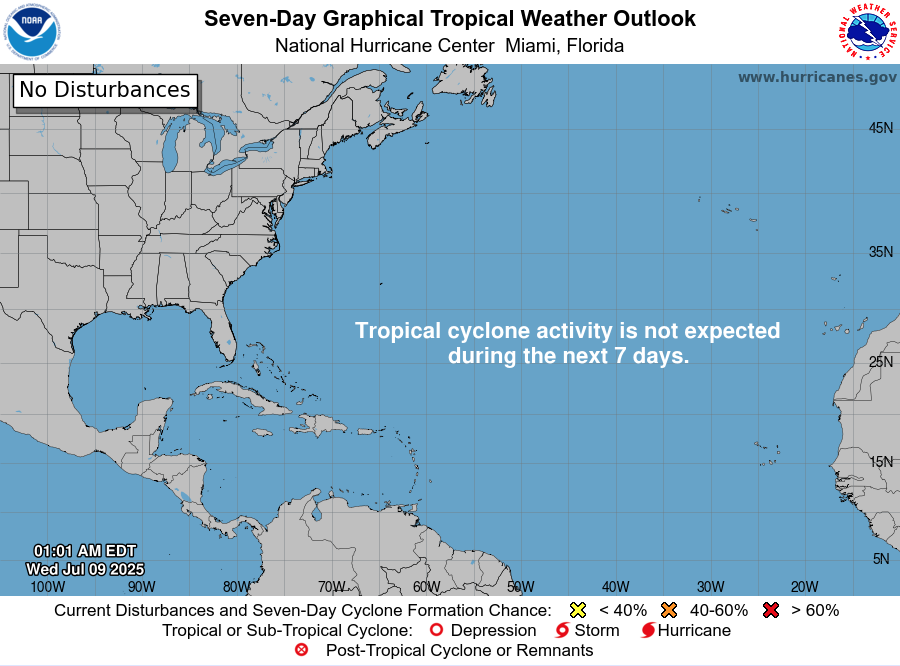
Mid-July typically signals more tropical activity—but today, the Atlantic remains unusually quiet. According to the latest NHC updates, no tropical cyclones are present, with no expected development over the next seven days. Despite the current calm, strong indicators suggest the season’s intensity is primed to rise.
Atlantic Basin: All Clear for Now
No active systems in the Atlantic, Caribbean, or Gulf
NHC forecast maintains zero development chances across the basin
This lull is rare for July and may end soon as heat and moisture build
Satellite view via Windy.com
Seasonal Outlook: Above-Normal Conditions Ahead
CSU’s July update continues to forecast an above-average season:
~17 named storms, including ~9 hurricanes and ~4 major hurricanes .NOAA similarly predicts 13–19 named storms, with a 60% chance of a busier-than-average season.
Sea Surface Temperatures: High Heat Levels
Atlantic SSTs remain well above normal—2–4°F above average—in the Gulf, Caribbean, and MDR
These elevated temperatures continue to provide plenty of energy for storm formation in the weeks ahead
Sea Surface Temperature via Windy.com
Atmospheric Conditions: Secondary Barriers Easing

Wind Shear Courtesy of https://tropic.ssec.wisc.edu/
Wind shear remains moderate-to-high, particularly in the eastern Atlantic—temporarily limiting development
Saharan Air Layer (SAL) and occasional dry mid-level air still suppress convection but are expected to diminish
Moisture is steadily increasing, with abundant humidity projected across storm-prone regions
Saharan Air Layer (Dust) via Windy.com
What to Watch Next
Upcoming Infrared and visible satellite loops for signs of organization
Shifts in wind shear over the Gulf and Caribbean
Any African easterly waves gaining moisture and structure
Wind Gust Accumulation Forecast (ECMWF) via Windy.com
Early July Trends
Only one named storm (Chantal) has formed so far, but it remained weak and quickly dissipated
History shows many July systems originate in the Gulf, Caribbean, or off the Southeast U.S. coast
Outlook: Active Patterns Brewing
While quiet now, the combination of warm SSTs, moist air, and weakening shear/SAL signals a rising likelihood of Atlantic development
Hurricane Season Peak is still ahead—August through October—but increased vigilance is essential now
Prep Tip of the Day: Check Your Alert Systems
With the season expected to intensify:
Confirm NOAA Weather Radio is operational
Enable emergency alerts on all devices
Update your hurricane kit and evacuation plan
Bookmark Cat5Prep.com and the National Hurricane Center for future updates
The Atlantic remains calm—but the foundation for tropical activity is strengthening daily. Stay alert, stay prepared, and check back tomorrow for your next Cat5Prep.com outlook.