
Atlantic Hurricane Outlook – July 26, 2025: Gulf Moisture Lingers, Deep Tropics Show Early Signs of Change
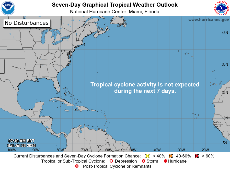
The Atlantic basin remains free of any named tropical cyclones, but not without activity. A persistent disturbance in the western Gulf of Mexico continues to funnel tropical moisture into parts of Texas and Louisiana, while multiple tropical waves in the deep Atlantic are stirring early signals of future development.
This mid-season quiet is not unusual—but subtle shifts are beginning to show across the basin. As we approach August, conditions will slowly lean more favorable for storm formation.
Gulf of Mexico: Persistent Moisture, Low Development Potential
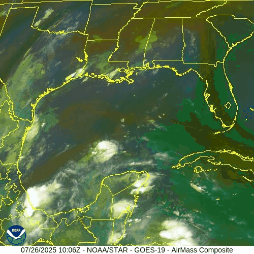
NOAA/NESDIS/STAR – GOES-19 Air Mass Composite – July 26, 2025 (Gulf)
A weak surface trough remains in the western Gulf of Mexico, associated with disorganized showers and thunderstorms.
Current Status: No surface circulation, limited upper-level support
Rain Impacts: Coastal Texas and Louisiana remain under intermittent showers and thunderstorms through the weekend
Development Chance: Still near 0%—but the system is being monitored for changes
Elsewhere in the Gulf, conditions remain stable, with light to moderate winds and seas of 2–5 ft across most zones.
Tropical Waves: Marching Westward, Holding Potential
Several tropical waves remain active in the central and eastern Atlantic:
Wave near 40°W: Moving west at ~10–15 kt, producing scattered convection. Still disorganized but in warm waters with marginal wind shear.
Wave near 23°W (off Africa): Embedded in the monsoon trough. Convection flaring along southern flank; too early for development but bears watching.
None of these waves currently show signs of imminent organization, but they are tracking into warmer waters and a slowly improving environment.
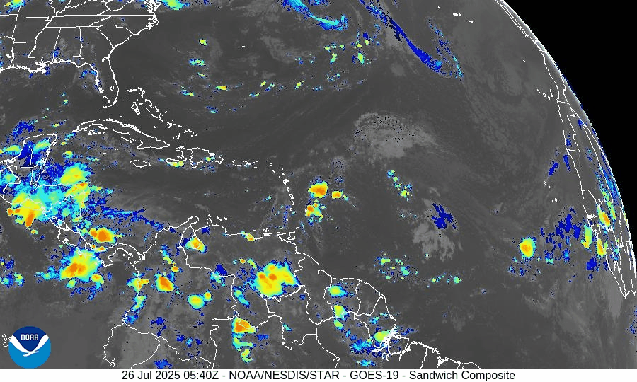
NOAA/NESDIS/STAR – GOES-19 Sandwich Composite – July 26, 2025 (Tropical Atlantic)
Sea Surface Temperatures: Primed for August
Gulf of Mexico: 86–88°F across most areas
Caribbean Sea: Upper 80s°F, especially in the western basin
Main Development Region (MDR): 82–84°F, 1–2°F above average
The Atlantic remains historically warm, a key ingredient for fueling tropical cyclones as we near peak season.
SST data courtesy of Windy.com
Atmospheric Conditions: Gradual Shift Unfolding
Wind Shear: Still moderate in the central Atlantic, but weakening trends are forecast
Moisture: Mid-level moisture increasing, especially south of 20°N
Saharan Air Layer (SAL): Still active, but thinning between 35°W–50°W
These slow, quiet changes signal a transition to a more favorable setup in early August.
Dust & SAL data from Windy.com
Florida Forecast
Today’s Weather:
High: 90°F
Conditions: Partly sunny, humid
Storm Risk: Scattered inland thunderstorms after 2 PM
Winds: Light and variable
Prep Reminder: Monitor drainage around your property during afternoon storms
Rain forecast data courtesy of Windy.com
Prep Tip of the Day: Check Local Shelters & Pet Plans
Locate your nearest hurricane shelter—especially if you're new to your area
Identify which shelters allow pets (many do, but require pre-registration)
Add leash, crate, and vaccination documents to your go-kit
Looking Ahead: Window of Quiet Before August Heats Up
Although no named systems are expected in the next 5–7 days, the setup across the basin is gradually shifting. The Gulf disturbance remains weak, but new tropical waves are aligning with less hostile conditions.
This is the time to finalize your hurricane supplies, prep your property, and stay informed.
Check back tomorrow for another update from Cat5Prep.com.