
Atlantic Hurricane Outlook – July 9, 2025: Calm Seas Persist Amid Seasonal Build
The Atlantic remains quiet today, with no active storms and no development expected. But record-warm waters and shifting atmospheric patterns suggest that tropical activity could ramp up soon.
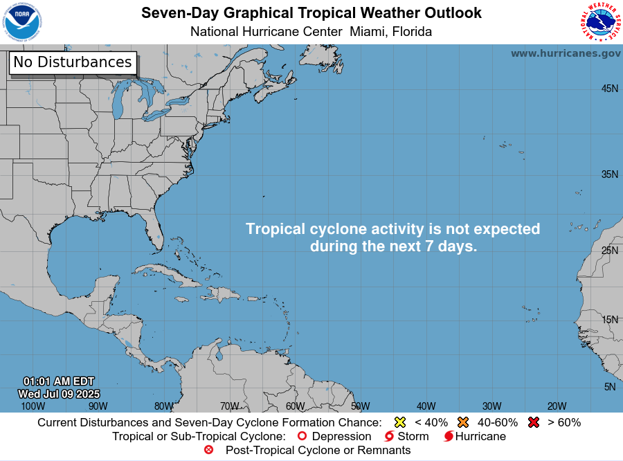
Mid-July typically signals more tropical activity—but today, the Atlantic remains unusually quiet. According to the latest NHC updates, no tropical cyclones are present, with no expected development over the next seven days. Despite the current calm, strong indicators suggest the season’s intensity is primed to rise.
Atlantic Basin: All Clear for Now
No active systems in the Atlantic, Caribbean, or Gulf
NHC forecast maintains zero development chances across the basin
This lull is rare for July and may end soon as heat and moisture build
Satellite view via Windy.com
Seasonal Outlook: Above-Normal Conditions Ahead
CSU’s July update continues to forecast an above-average season:
~17 named storms, including ~9 hurricanes and ~4 major hurricanes .NOAA similarly predicts 13–19 named storms, with a 60% chance of a busier-than-average season.
Sea Surface Temperatures: High Heat Levels
Atlantic SSTs remain well above normal—2–4°F above average—in the Gulf, Caribbean, and MDR
These elevated temperatures continue to provide plenty of energy for storm formation in the weeks ahead
Sea Surface Temperature via Windy.com
Atmospheric Conditions: Secondary Barriers Easing

Wind Shear Courtesy of https://tropic.ssec.wisc.edu/
Wind shear remains moderate-to-high, particularly in the eastern Atlantic—temporarily limiting development
Saharan Air Layer (SAL) and occasional dry mid-level air still suppress convection but are expected to diminish
Moisture is steadily increasing, with abundant humidity projected across storm-prone regions
Saharan Air Layer (Dust) via Windy.com
What to Watch Next
Upcoming Infrared and visible satellite loops for signs of organization
Shifts in wind shear over the Gulf and Caribbean
Any African easterly waves gaining moisture and structure
Wind Gust Accumulation Forecast (ECMWF) via Windy.com
Early July Trends
Only one named storm (Chantal) has formed so far, but it remained weak and quickly dissipated
History shows many July systems originate in the Gulf, Caribbean, or off the Southeast U.S. coast
Outlook: Active Patterns Brewing
While quiet now, the combination of warm SSTs, moist air, and weakening shear/SAL signals a rising likelihood of Atlantic development
Hurricane Season Peak is still ahead—August through October—but increased vigilance is essential now
Prep Tip of the Day: Check Your Alert Systems
With the season expected to intensify:
Confirm NOAA Weather Radio is operational
Enable emergency alerts on all devices
Update your hurricane kit and evacuation plan
Bookmark Cat5Prep.com and the National Hurricane Center for future updates
The Atlantic remains calm—but the foundation for tropical activity is strengthening daily. Stay alert, stay prepared, and check back tomorrow for your next Cat5Prep.com outlook.