Atlantic Hurricane Outlook – September 29, 2025
Imelda strengthens while turning away from U.S.; Humberto continues well offshore

Atlantic Basin Overview
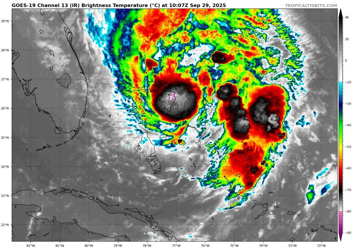
Tropical Storm Imelda
At 5:00 AM EDT, Imelda was located near 25.5° N, 77.1° W, about 60 miles south of Great Abaco Island and approximately 295 miles southeast of Cape Canaveral, Florida. It’s moving north at about 8 mph. Imelda’s maximum sustained winds are about 45 mph, and its central pressure is ~996 mb. It is forecast to turn east-northeast by Tuesday, likely staying offshore of the southeastern U.S. coast. Imelda is expected to strengthen, possibly to hurricane status.Tropical-storm-force winds currently extend outward up to 175 miles, mostly on the eastern side of the storm.
Rainfall totals of 1–2 inches (with isolated maxima up to 4 inches) are expected across northeast Florida, coastal South Carolina, and southeast North Carolina through Tuesday.
Storm surge of 1 to 2 feet is possible along the southeast U.S. coastline (Volusia/Brevard FL to South Santee River SC) in areas with onshore winds.
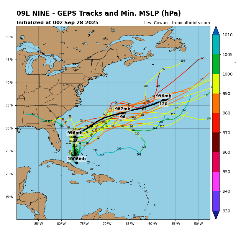
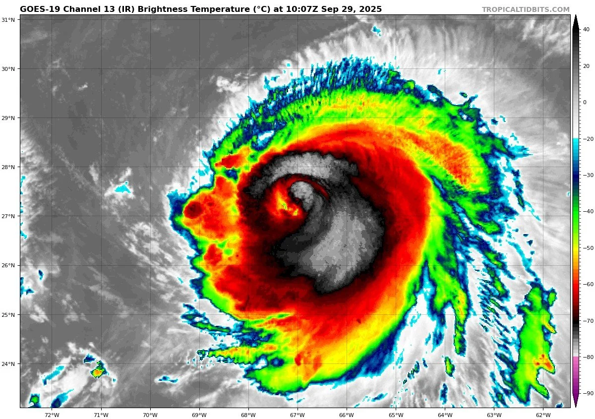
Hurricane Humberto & Other Waves
Imelda and Humberto are generating swells that impact large regions of the Atlantic. Swell from Humberto will continue to spread west and affect U.S. East Coast waters.Meanwhile, Humberto remains a separate system well offshore and not currently expected to threaten land.
Additional waves in the Atlantic remain under observation, but none currently show strong organization or direct paths toward the U.S. coast.
Tropical Storm Imelda


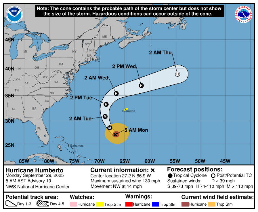
Hurricane Humberto


Environmental Conditions
Sea Surface Temperatures (SSTs): Warm SSTs remain supportive near Imelda’s track and in regions ahead of it. However, as Imelda moves northeast, it will encounter cooler waters that may slow further intensification.
Wind Shear: Moderate shear is present around Imelda, which may slow rapid strengthening. As the storm turns east-northeast, it may be met with increasing shear in the mid-latitude flow.
Humidity & Dry Air / Saharan Air Layer (SAL): Pockets of dry air and SAL influence persist, especially east of Imelda, suppressing convective growth in outer bands. These factors also limit development potential of other Atlantic waves.

Gulf of America & Caribbean
The Gulf of America and Caribbean remain quiet. No tropical systems are currently organizing or showing signs of imminent development.
Florida & Eastern U.S. Forecast
Florida & Southeast U.S.: The center of Imelda is expected to remain offshore. However, coastal and inland areas (especially northeast Florida up through the Carolinas) may see tropical-storm-force gusts, heavy rainfall, and coastal flooding from storm surge and waves.
Marine Impacts: Swells and rough surf from Imelda and Humberto will produce life-threatening surf and rip current conditions along the East Coast, including Florida’s Atlantic beaches.
Rain forecast visualization courtesy of Windy.com
TL;DR – September 29 Snapshot
Imelda is strengthening, located near the Bahamas, moving north, expected to turn east-northeast and remain offshore.
The storm could reach hurricane status, with tropical-storm conditions extending outward 175 miles.
Rain, wind, and surge effects are expected along the U.S. Southeast and Atlantic coast, though landfall is unlikely in Florida.
SSTs favorable now, but shear and dry air will increasingly resist intensification.
Gulf and Caribbean remain calm; U.S. East Coast should watch surf and rip current risks.