Atlantic Hurricane Outlook – September 26, 2025

Gabrielle transitions to post-tropical near the Azores; Humberto strengthens in the Atlantic
Atlantic Basin Overview
Post-Tropical Cyclone Gabrielle
Gabrielle has weakened and become a post-tropical cyclone, located near 39.1°N, 26.1°W, moving east-northeast at about 29 mph with maximum sustained winds near 65 mph. The system is still producing tropical-storm conditions with gusts to hurricane force across parts of the Azores, where a hurricane warning remains in effect. Gabrielle will continue to weaken as it tracks into cooler waters, transitioning fully into an extratropical system.Hurricane Humberto
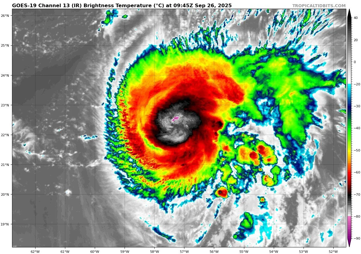
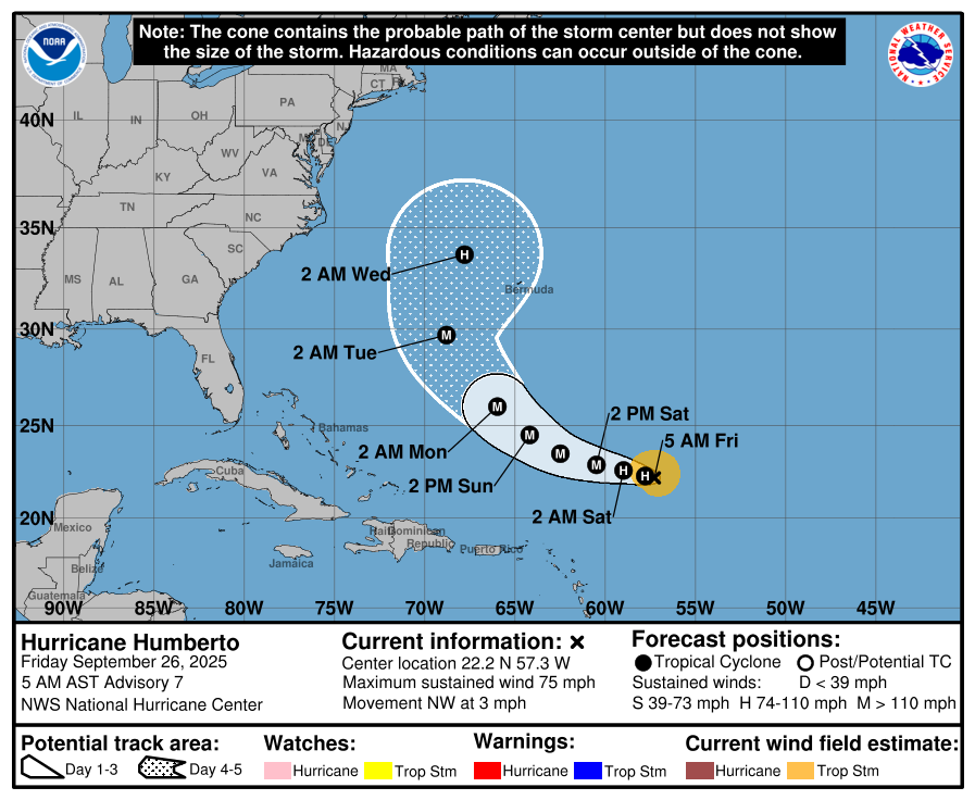
Humberto has strengthened into a hurricane northeast of the Leeward Islands. Forecast guidance suggests continued intensification in the coming days. Current tracks keep Humberto over the open Atlantic, posing no direct threat to the U.S. East Coast or Florida at this time.Other Disturbances / Waves
The NHC is also monitoring additional tropical waves across the Atlantic. None are currently organized, and environmental conditions are not favorable for rapid development.
Hurricane HUMBERTO


Invest 94L


Environmental Conditions
Sea Surface Temperatures (SSTs): SSTs remain supportive in parts of the Atlantic, helping maintain Humberto’s strength. Gabrielle is moving into cooler waters, which is contributing to its weakening trend.
Wind Shear: Increasing wind shear is disrupting Gabrielle’s structure and will continue to suppress further organization. Humberto is in a more favorable low-shear environment, aiding intensification.
Humidity & Dry Air (SAL): Mid-level dry air and Saharan Air Layer dust continue to suppress convection in the eastern Atlantic, limiting development for weaker tropical waves.
Gulf of America & Caribbean
The Gulf of America and Caribbean remain calm, with no organized tropical systems. Scattered thunderstorms and late-summer showers continue, but there are no signs of tropical development.
Florida & Eastern U.S. Forecast
Florida remains free of any tropical threats. The primary hazard along the Eastern U.S. coastline comes from Gabrielle’s swells, which are still producing dangerous surf and rip currents along Atlantic beaches. Inland Florida continues with typical hot, humid late-September weather and scattered afternoon thunderstorms.
Rain forecast visualization courtesy of Windy.com

TL;DR – September 26 Snapshot
Gabrielle is now a post-tropical cyclone, still impacting the Azores but weakening.
Humberto has intensified into a hurricane, tracking safely over the open Atlantic.
SSTs support Humberto, while wind shear and dry air weaken Gabrielle and limit other waves.
Gulf of America, Florida, and Eastern U.S. face no direct tropical threats; main concern remains marine hazards from swell and rip currents.