
Atlantic Hurricane Outlook – July 22, 2025: Tropics Stirring, But Development Remains Gradual

The Atlantic basin remains free of named storms this morning, but the deep tropics are showing increased activity. Multiple tropical waves are marching across the basin—some with disorganized convection, others with early signs of circulation. While none are forecast to develop imminently, the atmospheric stage is being set for a more active period as we approach late July.
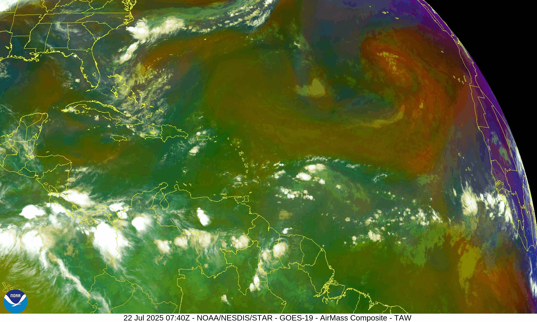
Atlantic Basin: Several Waves Under Watch
As of the 8:00 AM EDT Tropical Weather Outlook from the National Hurricane Center (NHC):
No active tropical cyclones
Two tropical waves of interest:
Central Atlantic wave near 45°W: Still disorganized, no longer showing on NOAA Seven-Day TWO , moving westward at 10–15 knots. Scattered convection continues, and models suggest a more favorable environment as it approaches the Caribbean later this week.
Chance of development over 7 days: Low (20%)Far Eastern Atlantic wave near 27°W: Recently emerged off Africa. Some associated convection along its southern flank, but no signs of organization yet.
Both systems are embedded in the broader Monsoon Trough, which is supporting shower and thunderstorm development across the deep tropics.
Sea Surface Temperatures: Favorable and Climbing
Ocean waters remain well above average in key areas:
Gulf of Mexico: 86–90°F (30–32°C) across most of the basin
Western Caribbean: Steady warming, ideal for storm fuel
Main Development Region (MDR): 1–2°C above normal across much of the eastern and central Atlantic
These conditions provide a supportive foundation for any systems that organize over the coming weeks.
Sea Surface Temperature data courtesy of Windy.com
Wind Shear and Atmospheric Conditions: Mixed Signals

Wind Shear Courtesy of https://tropic.ssec.wisc.edu/
Wind shear is moderate across much of the Caribbean and central Atlantic, but is beginning to weaken in pockets—especially south of 20°N.
Moisture levels in the mid and lower atmosphere continue to rise, supporting the recent uptick in convection.
Dry air from the Saharan Air Layer (SAL) still lingers across parts of the eastern Atlantic but is beginning to fragment—reducing one of the main inhibitors to development.
Relative Humidity (ECMWF) data courtesy of Windy.com
Saharan Air Layer (Dust) data courtesy of Windy.com
Thunderstorm Activity: Widespread in the Deep Tropics
Clusters of convection are active:
Along the monsoon trough from 10°N to 15°N between 25°W and 50°W
In the western Caribbean, especially south of Jamaica, where upper-level support is creating isolated thunderstorms
Over Central America and the Yucatán Peninsula, where diurnal heat is triggering inland storms
These are not organized tropical systems—but they reflect a broader shift toward a more favorable convective environment.
Thunderstorm forecast (ECMWF) courtesy of Windy.com
Florida Forecast: Hot, Humid, and Stormy
Expect a classic Florida summer day:
North Florida: Highs in the upper 80s to low 90s°F, scattered PM storms
Central Florida: Around 91°F with heat index nearing 102°F; thunderstorms likely between 2–7 PM
South Florida: Mid-to-upper 80s, muggy, with pockets of heavy rainfall inland
Localized flooding is possible in low-lying areas during heavy downpours.
Rainfall forecast (ECMWF) courtesy of Windy.com
Prep Tip of the Day: Recheck Insurance Coverage
Use this quiet window to review your insurance:
Verify your hurricane deductible and coverage limits
Make sure flood insurance is in place—it typically has a 30-day waiting period
Store digital copies of policies in a secure cloud folder
Photograph your home’s exterior and interior for pre-storm documentation
Looking Ahead: No Immediate Threats, But the Tropics Are Heating Up
While no storms are expected in the next 48 hours, the increasing wave activity, warm ocean waters, and weakening SAL suggest the tropics are transitioning into a more active phase. Late July into early August is a known ramp-up period for development.
Stay alert, stay ready, and check back tomorrow for your Cat5Prep.com hurricane update.