
Atlantic Hurricane Outlook – September 1, 2025
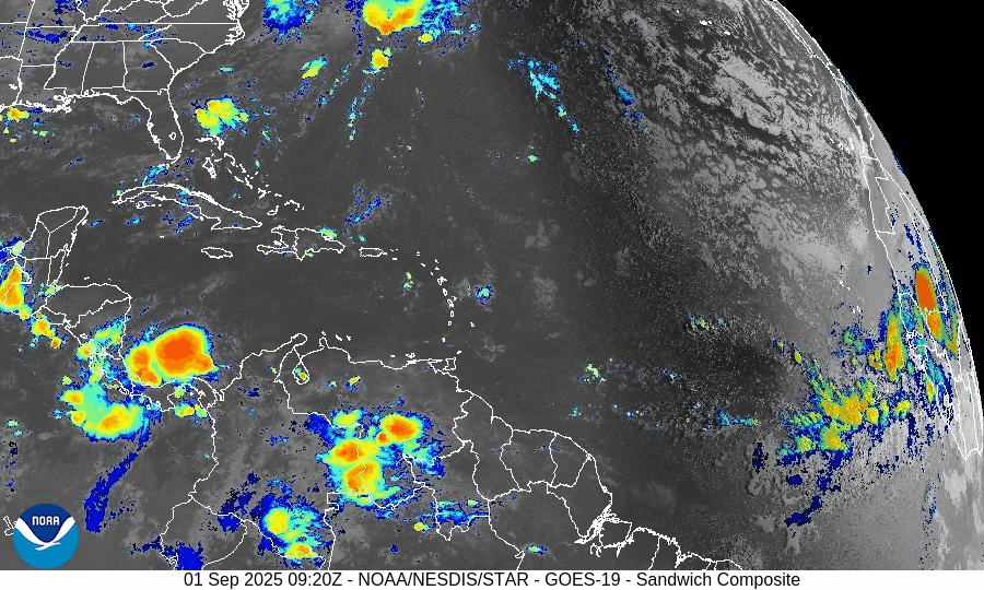
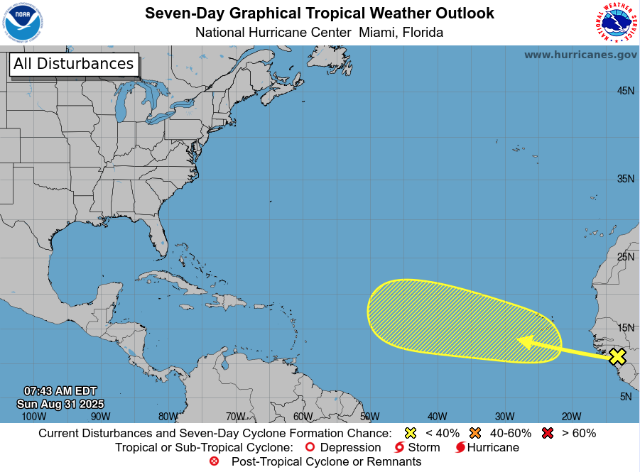
On September 1, the Atlantic remains storm-free with no active cyclones. A tropical wave emerging off the coast of Africa carries a 40% chance of development over the next 7 days. While environmental conditions—wind shear, dry air, and Saharan dust—are suppressing rapid growth, the wave will be monitored closely. Florida and the Gulf of Mexico remain quiet, experiencing only typical early-September thunderstorms.

TLDR Version: Click Here
Atlantic remains quiet; tropical wave off Africa shows rising potential (40% over 7 days)
Atlantic Basin Overview
No Active Storms
There are currently no active tropical cyclones in the Atlantic basin—the first tranquil period we've seen since the wake of Fernand and Erin.Emerging Tropical Wave Off Africa
A new tropical wave has emerged off the West Coast of Africa near Guinea-Bissau. Presently disorganized, the NHC assigns it a 0% chance of development in the next 48 hours, but the probability rises to about 40% over the next 7 days. This system will be closely monitored as it moves west across the tropical Atlantic.
Environmental Conditions
Sea Surface Temperatures (SSTs): Remain warm in the Gulf and Caribbean (29–31 °C), while the open Atlantic heat content diminishes northward.
Wind Shear: Elevated shear across much of the basin continues to suppress storm formation.
Mid-Level Humidity & SAL (Saharan Air Layer): Dry air and SAL dust are widespread, inhibiting significant convection and limiting the strength of the new wave emerging off Africa.
Gulf of America & Caribbean
The Gulf remains stable and quiet, under the influence of high pressure. Only routine afternoon sea-breeze thunderstorms are expected—no tropical threats are present.
Florida & Southeast U.S. Forecast
Florida continues in its trademark late-August/early-September pattern: hot, humid, with scattered afternoon thunderstorms. With no active systems nearby, no coastal or tropical threats are expected this week.
Rain forecast visualization courtesy of Windy.com
Summary

No storms are currently active in the Atlantic basin.
A tropical wave off Africa is being monitored, with a 40% chance of developing within 7 days.
Environmental factors—including cool SSTs, strong shear, dry air, and SAL—are suppressing tropical development.
Gulf and Florida remain quiet, with only standard summertime weather patterns in play.
TL;DR – September 1 Snapshot
Atlantic is fully quiet; no active storms.
Tropical wave off Africa now has 40% 7-day development odds.
Hostile conditions in place, limiting immediate storm formation.
Florida and Gulf remain calm, aside from typical daily thunderstorms.

Atlantic Hurricane Outlook – August 31, 2025
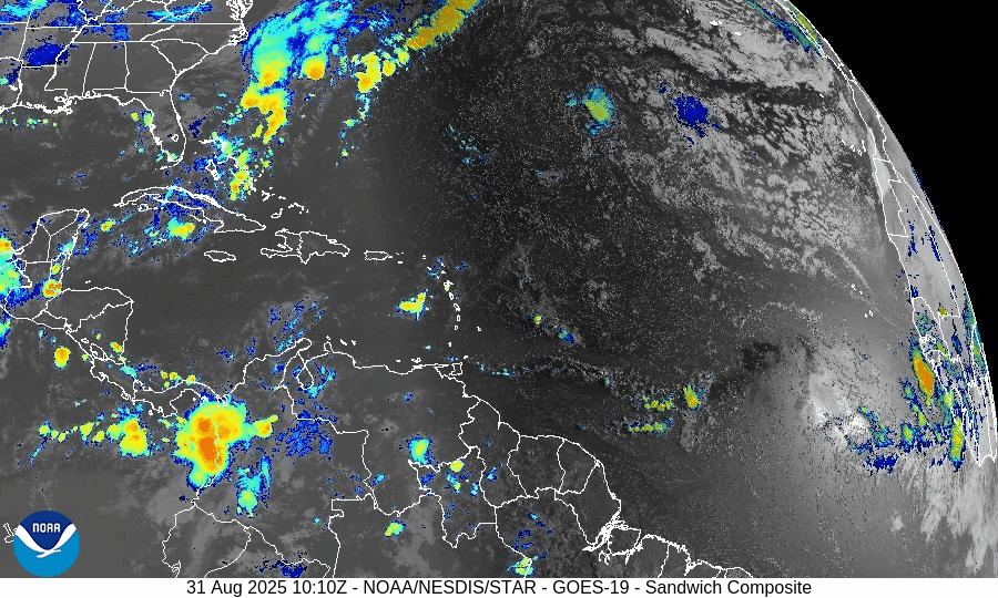
On August 31, the Atlantic remains storm-free following the dissipation of Fernand and Erin’s exit. The only feature of interest is a tropical wave moving off Africa, with a low 30% development chance over the next 7 days. Environmental conditions—wind shear, dry air, and Saharan dust—continue to limit storm formation. Florida and the Gulf remain calm aside from typical summer storms.

TLDR Version: Click Here
Atlantic basin remains quiet; a weak wave off Africa shows low (30%) development odds
Atlantic Basin Overview
No Active Storms
There are currently no active tropical cyclones in the Atlantic basin. The calm continues following Fernand’s dissipation and the end of Erin’s impacts.Tropical Wave Near Africa
A tropical wave is forecast to emerge off the west coast of Africa, and the NHC assigns it a low – but not negligible – chance of development: 0% over the next 2 days, increasing to 30% over the next 3 to 7 days.
Environmental Conditions
Sea Surface Temperatures (SSTs): Warm in the Caribbean and Gulf (~29–31 °C), but less favorable conditions in much of the open Atlantic.
Wind Shear: Continues to be elevated across large swaths of the basin, discouraging storm formation.
Mid-Level Humidity & SAL: Dry air and Saharan dust (SAL) remain prevalent, further suppressing convective activity.
Gulf of Mexico & Caribbean
The Gulf remains quiet and stable, dominated by high pressure. Only routine afternoon thunderstorms are occurring along the coasts—no tropical development is expected.
Florida & Southeast U.S. Forecast
Florida continues in its late-August pattern—hot, humid, with scattered afternoon thunderstorms. No tropical threats are present.
Beaches along the Atlantic coast are beginning to calm. With no new swells incoming, rip currents and surf conditions are generally improving, though caution remains prudent in areas still unsettled from earlier systems.
Rain forecast visualization courtesy of Windy.com
Summary

Atlantic basin is currently calm, with no tropical storms or hurricanes active.
A new tropical wave off Africa carries low (30%) development odds over the next week.
Environmental factors (cooler SSTs, shear, dry air, and SAL) continue to limit development potential.
Gulf and Florida remain storm-free, apart from the usual summer thunderstorms.
TL;DR – August 31 Snapshot
The Atlantic is quiet and free of active storms.
A wave off Africa has low (30%) chance of development by next week.
Environmental conditions remain unfavorable for new formations.
Florida and Gulf remain calm with only routine seasonal storms.

Atlantic Hurricane Outlook – August 29, 2025
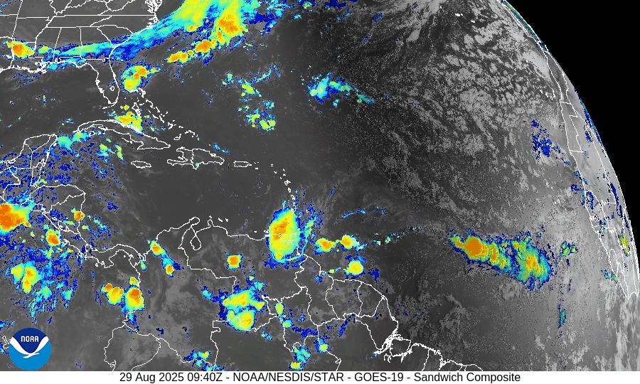
On August 29, Fernand dissipated in the far North Atlantic, marking the first quiet period in weeks across the basin. No tropical systems are active, though a weak wave off Africa shows low development potential. The Gulf of Mexico and Florida remain calm, experiencing only routine summer thunderstorms.

TLDR Version: Click Here
Fernand has dissipated; no active tropical storms, but a new wave off Africa warrants monitoring
Atlantic Basin Overview
Fernand Has Dissipated
Post-tropical Fernand has fully dissipated over the far North Atlantic. As of the last advisory on August 28, 0900 UTC, it was centered near 41.2°N, 42.9°W, moving east-northeast at ~23 mph with maximum winds of 35 knots (40 mph) and a minimum pressure of 1009 mb. No further advisories will be issued, and the system is no longer a threat to land.
No Active Tropical Systems
Currently, there are no active tropical storms or hurricanes in the Atlantic basin. Model tracking tools confirm the basin is completely clear of active systems.
New Disturbance Emerging Near Africa
The NHC is observing a tropical wave east of the Cabo Verde Islands. This wave features no significant convection and is currently under the influence of Saharan dust. While its development odds are low in the short term, there’s a 20% chance of development over the next 7 days.
Environmental Conditions
Sea Surface Temperatures (SSTs): Warm waters (~29–31 °C) persist in the Gulf and Caribbean, but cooling temperatures across the open Atlantic now that Fernand is gone.
Wind Shear: Elevated wind shear continues to suppress development across most of the Atlantic.
Mid-Level Relative Humidity & Saharan Air Layer (SAL): Dry air and SAL dust are prevalent—particularly near the new wave off Africa—further hampering development.
Gulf of America (Mexico) & Caribbean
The Gulf remains quiet and stable, with high pressure dominating. Only typical afternoon thunderstorms are expected; no organized or tropical development is forecast.
Florida & Southeast U.S. Forecast
Florida continues to experience standard late-summer weather—hot, humid, with scattered afternoon thunderstorms. The absence of major tropical features means no new coastal threats.
Atlantic beaches are finally beginning to calm after prolonged rough surf from previous systems, though caution remains advised where noticeable wave action persists.
Rain forecast visualization courtesy of Windy.com
Summary

Fernand has dissipated; no tropical cyclones remain in the Atlantic.
Atlantic remains quiet, with only a small wave emerging near Africa carrying limited development potential.
Environmental factors—cooler SSTs, wind shear, dry air, and SAL—continue to suppress tropical activity.
Gulf and Florida show no signs of tropical development, carrying on with typical summer weather patterns.
TL;DR – August 29 Snapshot
Fernand is no longer active and poses no threat.
Atlantic basin is quiet—only a minor wave off Africa is being watched.
Environmental conditions remain unfavorable for storm formation.
Florida and Gulf continue with routine stormy weather; beaches are calming.
