Atlantic Hurricane Outlook – September 10, 2025
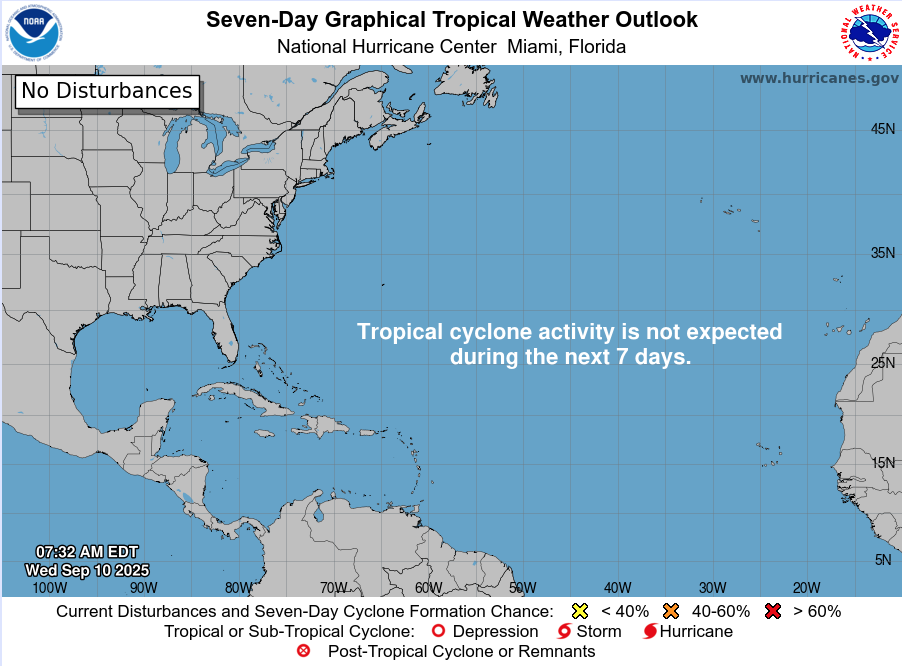
On September 10, the Atlantic basin remains calm despite being the statistical peak of hurricane season. No tropical cyclones are active, and the National Hurricane Center does not expect development over the next week. Dry air, Saharan dust, and wind shear are keeping conditions hostile to storm formation. Florida and the Gulf of Mexico remain quiet, with only the typical late-summer pattern of heat, humidity, and afternoon thunderstorms.

Atlantic remains exceptionally calm during climatological peak; no tropical development expected
Atlantic Basin Overview
No Active Systems
Despite reaching the climatological peak of hurricane season (September 10), the Atlantic basin remains completely quiet—no tropical depressions, storms, or hurricanes are present. The National Hurricane Center’s 7-day outlook again shows no expected development.
The season's accumulated cyclone energy (ACE) across the Northern Hemisphere is currently below 60% of average, further emphasizing the unusual lull.
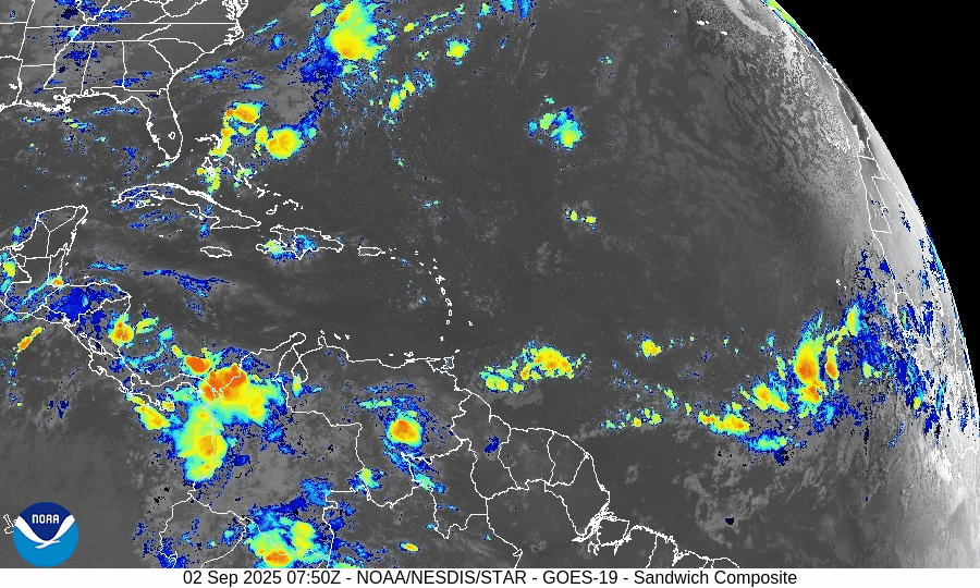
Last week’s disturbance—once showing high development potential near the Caribbean—dissipated after ingesting dry, dusty air from the Sahara.
Environmental Conditions
Sea Surface Temperatures (SSTs): Subtropics indicate record-warm SSTs, while much of the tropical Atlantic remains cooler than last year, reducing atmospheric instability and suppressing storm formation.
Atmospheric Conditions: Saharan dust plumes and a notably weak lapse rate in the atmosphere continue to inhibit convective development across the basin.
Looking Ahead: Meteorologists anticipate that activity may increase from late September into October. This is driven by the expected arrival of the Madden-Julian Oscillation (MJO) and continuing La Niña trends, both of which tend to support tropical cyclone development.
Gulf of Mexico & Caribbean
No tropical threats are present. High-pressure dominance continues to maintain calm conditions, aside from normal afternoon sea-breeze thunderstorms.
Florida & Southeast U.S. Forecast
Florida remains in its typical late-summer pattern: hot, humid, with scattered afternoon storms. With no tropical systems in the Atlantic or Gulf, no coastal or tropical hazards are expected this week.
Rain forecast visualization courtesy of Windy.com

Summary
The Atlantic basin is quiet, with no storms active or expected over the next 7 days.
Suppressive factors—cooler SSTs, dry air, Saharan dust, and weak atmospheric instability—continue to dominate.
Although conditions are currently unfavorable, model and observational insights suggest a potential pickup in tropical activity later this month as MJO and La Niña factors emerge.
Gulf and Florida remain unaffected, encountering only routine late-summer weather.
TL;DR – September 10 Snapshot
No activity in the Atlantic—still quiet at hurricane season peak.
Atmospheric conditions strongly suppress development: dry air, dust, and cool SSTs.
Climatology points to a possible uptick in activity toward late September/October.
Florida and the Gulf stay quiet—just the usual stormy afternoons.

Atlantic Hurricane Outlook – September 2, 2025
On September 2, the Atlantic remains storm-free with no active tropical cyclones. A tropical wave emerging off the coast of Africa shows rising organization and carries a 70% chance of development within 7 days. Environmental conditions are gradually improving, though dry air and Saharan dust remain factors. The Gulf of Mexico and Florida stay calm with only typical early-September thunderstorms.

TLDR Version: Click Here
Atlantic remains quiet; African wave gaining strength with a 70% 7-day development chance
Atlantic Basin Overview
No Active Storms
The Atlantic basin remains clear of any active tropical cyclones.Tropical Wave Emerging off Africa
A tropical wave located south of the Cabo Verde Islands is showing signs of organization. Environmental conditions are becoming more favorable, prompting a forecast of a low 30% chance of formation in the next 48 hours, rising significantly to a high 70% chance of development over the next 7 days.
Environmental Conditions
Sea Surface Temperatures (SSTs): Remain warm (~29–31 °C) in the Caribbean and Gulf, supportive for tropical development. Cooler conditions persist in the open Atlantic.
Wind Shear: Moderate to strong across much of the Atlantic; however, shear is forecast to ease gradually across the eastern tropical Atlantic, aiding organization of the wave.
Mid-Level Humidity & SAL: While dry air and Saharan Dust (SAL) remain present, pockets of increasing moisture near the African wave are aiding its potential development.
Gulf of America (Mexico) & Caribbean
The Gulf remains quiet, dominated by high pressure. Expect only daily sea-breeze afternoon thunderstorms—no tropical development is anticipated.
Florida & Southeast U.S. Forecast
Florida continues with typical early-September weather—hot, humid, and prone to scattered afternoon thunderstorms. There are no tropical threats or coastal hazards affecting the state at this time.
Rain forecast visualization courtesy of Windy.com
Summary

Atlantic basin remains calm, but one African wave shows high development potential (70%) over 7 days.
Environmental factors including SSTs, shear, moisture, and SAL will determine whether it organizes.
Gulf and Florida experience routine late-summer weather; no tropical systems in the near term.
TL;DR – September 2 Snapshot
Atlantic quiet with no storms.
70% chance a wave near Africa develops in the next 7 days.
Warm SSTs but competing shear and dry air—watch environment closely.
Florida and Gulf remain in standard summer pattern.