

Atlantic Hurricane Outlook – June 5, 2025: A Weak Low, a Wet Southeast, and a Watchful Eye
June 5 brings continued calm in the Atlantic, with no named storms and no areas of concern. But warm sea surface temperatures and slowly shifting atmospheric conditions suggest more activity may be on the way later this month.
The fifth day of the 2025 Atlantic hurricane season begins with calm skies and no tropical activity on the horizon. While this early June quiet is typical, forecasters are closely watching for subtle atmospheric shifts that may usher in increased activity later in the month. Now is the perfect time to double-check your emergency plans while the weather remains cooperative.
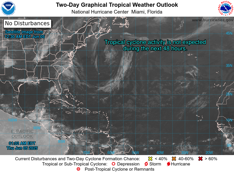
Atlantic Basin: No Immediate Concerns
As of the latest National Hurricane Center (NHC) update (8 PM EDT June 4 or the upcoming 2 AM EDT June 5 outlook):
No active tropical cyclones
No areas of interest under investigation
No development expected within the next 7 days
This quiet pattern aligns with the early season lull seen in most years before conditions ramp up later in June and July.
Satellite imagery courtesy of Windy.com
Sea Surface Temperatures: Warming Trend Continues
Ocean heat—an essential ingredient for tropical storm formation—is building across the Atlantic:
Gulf of America (Mexico): Widespread low to mid-80s°F (28–30°C), running above average
Western Caribbean: Seasonally warm, primed for potential development in coming weeks
Main Development Region (MDR): Temperatures are climbing faster than usual for early June, laying a foundation for future storms
Sea surface temperature data courtesy of Windy.com
Wind Shear & Moisture: Still Mixed, Slowly Improving
Atmospheric conditions aren’t yet fully supportive of tropical formation, but change is underway:
Wind Shear: Still moderate to high in the western Caribbean and central Atlantic—strong enough to disrupt organization. Long-range models show a gradual easing expected later in June
Moisture: Mid- and lower-atmosphere humidity is rising in the Gulf and Caribbean, hinting at increasing thunderstorm potential
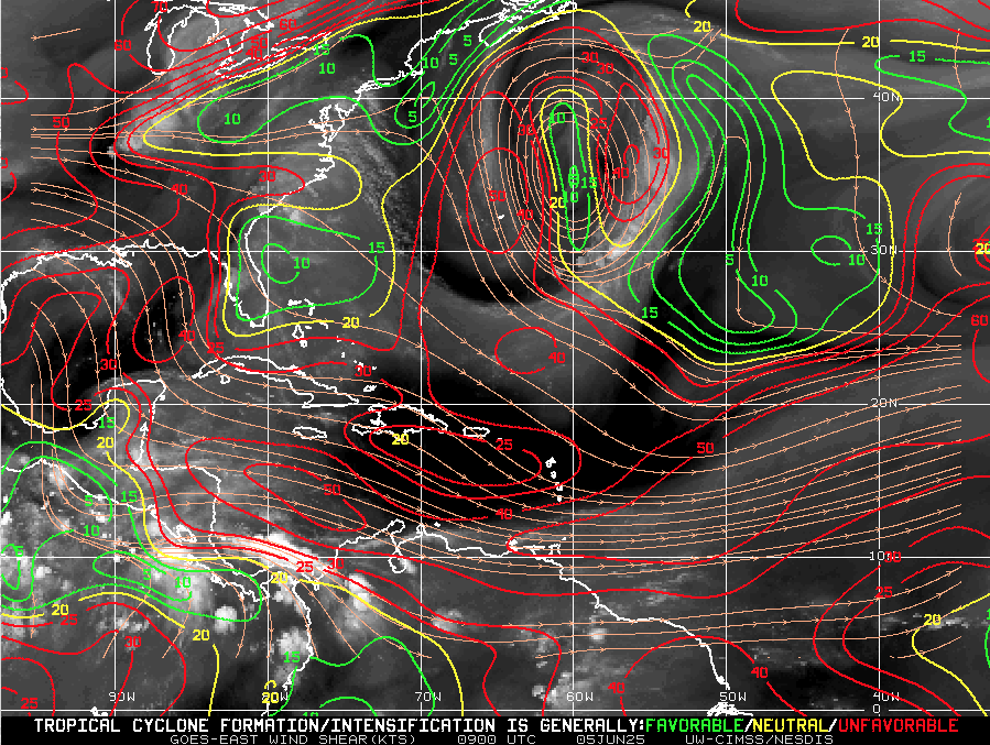
Wind Shear Courtesy of https://tropic.ssec.wisc.edu/
Saharan Air Layer: Strong, But Temporary Barrier
The Saharan Air Layer (SAL) remains a major suppressing force across the tropical Atlantic:
Dry, dusty air and associated wind shear prevent tropical waves from organizing
This layer is expected to weaken by mid-to-late June, removing a key obstacle to development
Saharan Air Layer data courtesy of Windy.com
Thunderstorm Activity: Typical Early Summer Patterns
No tropical cyclones—but thunderstorm activity continues in familiar places:
Florida: Scattered afternoon storms expected from daytime heating
Western Caribbean: Some disorganized convection is present but lacks structure
Off the U.S. East Coast: No significant organized convection at this time
Thunderstorm data courtesy of Windy.com
Florida Forecast – Early Summer Vibes Across the Peninsula
Expect a classic early summer day throughout Florida:
Highs: Upper 80s to low 90s°F (31–33°C) statewide
Humidity: Elevated levels bringing a muggy, tropical feel all day
Rain: Scattered afternoon thunderstorms likely, mostly brief and localized
Winds: Light and variable, with gentle breezes in many areas
Stay hydrated and be prepared for brief showers if you’re out and about this afternoon!
Radar data courtesy of Windy.com
Prep Tip of the Day: Verify Emergency Contact Information
Use this calm stretch to get communication-ready:
Update your family contact plan—make sure everyone knows who to call
Register for local emergency alerts via text or email
Bookmark vital sites like hurricanes.gov and Cat5Prep.com
Looking Ahead: Calm Now, But Stay Ready
No development is expected in the coming week—but the groundwork is being laid:
Warm waters across the basin
Easing wind shear on the horizon
Moisture and instability beginning to rise
The tropics may be quiet today, but the story of the 2025 hurricane season is just beginning. Stay informed, stay ready—and check back tomorrow for the next Cat5Prep.com update.