
Atlantic Hurricane Outlook – August 20, 2025: A Couple Systems In The Atlantic
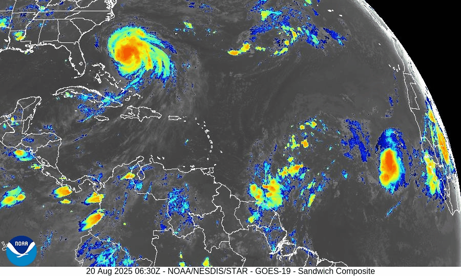
Hurricane Erin is holding as a Category 2 storm offshore, producing rip currents and coastal hazards along the East Coast. Meanwhile, the Gulf and Florida remain quiet, though tropical waves in the Atlantic are being monitored.
TLDR Version: Click Here
Current Tropical Systems

Hurricane Erin:
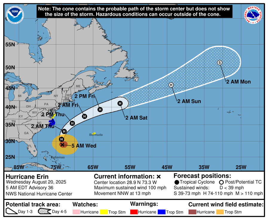
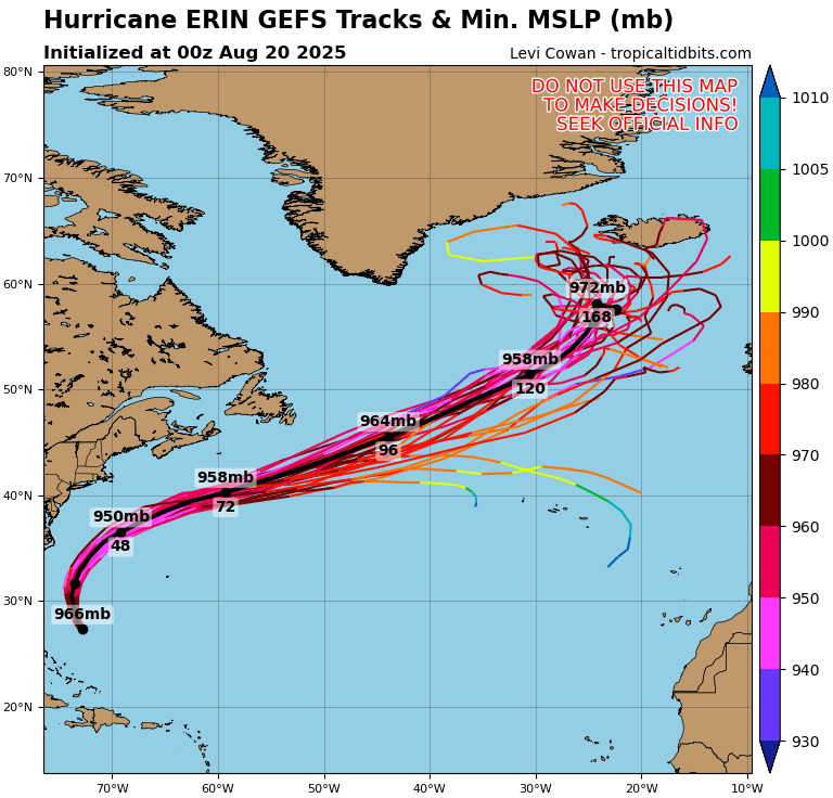
Erin has weakened slightly but remains a Category 2 hurricane as it tracks northeast, well offshore of the U.S. East Coast. The storm continues to generate dangerous swells, rip currents, and pockets of coastal flooding, especially from the Outer Banks northward into the Mid-Atlantic and New England. While direct landfall is not expected, coastal impacts remain significant.Disturbance in the Central Atlantic:
A tropical wave near 45°W continues to show signs of organization. Environmental conditions feature warm sea surface temperatures but are partially offset by moderate wind shear and Saharan Air Layer (SAL) dust intrusion. Development chances: 30% over 7 days.Far Eastern Atlantic Wave (off Africa):
A fresh wave near 25°W is emerging with scattered convection. It remains disorganized but will be monitored as it progresses westward. Development chances: low (20% over 7 days).


Gulf of America (Mexico) Outlook
The Gulf remains broadly quiet, with high pressure dominating and keeping conditions mostly stable. While moisture pockets are leading to afternoon thunderstorms, there are no signs of tropical development at this time. Sea surface temperatures are very warm (29–31°C), so the region will continue to be monitored closely heading into late August.
Florida Forecast
Florida remains under the influence of high humidity and afternoon sea-breeze thunderstorms, typical for August. Outer rainbands from Erin are not expected to impact the peninsula. No immediate tropical threats are forecast for the state in the near term.
Rain forecast visualization courtesy of Windy.com
Key Environmental Factors
Sea Surface Temperatures (SSTs): 29–31°C across the Gulf and Caribbean, MDR slightly above average — supportive for development.
Wind Shear: Moderate over the central Atlantic, helping limit wave organization.
Moisture: Gradual increase in the western Atlantic, but SAL dust continues to suppress deep convection in parts of the MDR.

Outlook Summary
Hurricane Erin remains a strong offshore system, generating significant surf and rip currents along the East Coast.
Central Atlantic disturbance carries moderate development potential but faces shear and dust challenges.
Gulf of Mexico and Florida remain calm with no immediate tropical concerns, though warm waters warrant close monitoring later this month.
TL;DR
Hurricane Erin is now a Category 2 offshore system, still driving dangerous surf and rip currents up the East Coast. The Gulf of Mexico and Florida stay quiet with only scattered thunderstorms, while the central Atlantic wave shows some development potential but is being held back by wind shear and Saharan dust.