
Atlantic Hurricane Outlook – July 18, 2025: Tropics Quiet, But Gulf Moisture Persists
The Atlantic remains free of tropical storms today, but rising ocean heat and evolving atmospheric patterns point to potential development in the coming weeks. Stay prepared with Cat5Prep's daily hurricane outlook.
The Atlantic basin remains relatively quiet as we enter the weekend, with no active tropical cyclones or immediate threats on the map. However, lingering moisture from a weak low in the Gulf of Mexico continues to impact parts of the Southeast with enhanced rain chances. Meanwhile, environmental signals are gradually shifting toward favorability as we move closer to the climatological ramp-up in late July.
Atlantic Basin: Still Quiet, But Watchful
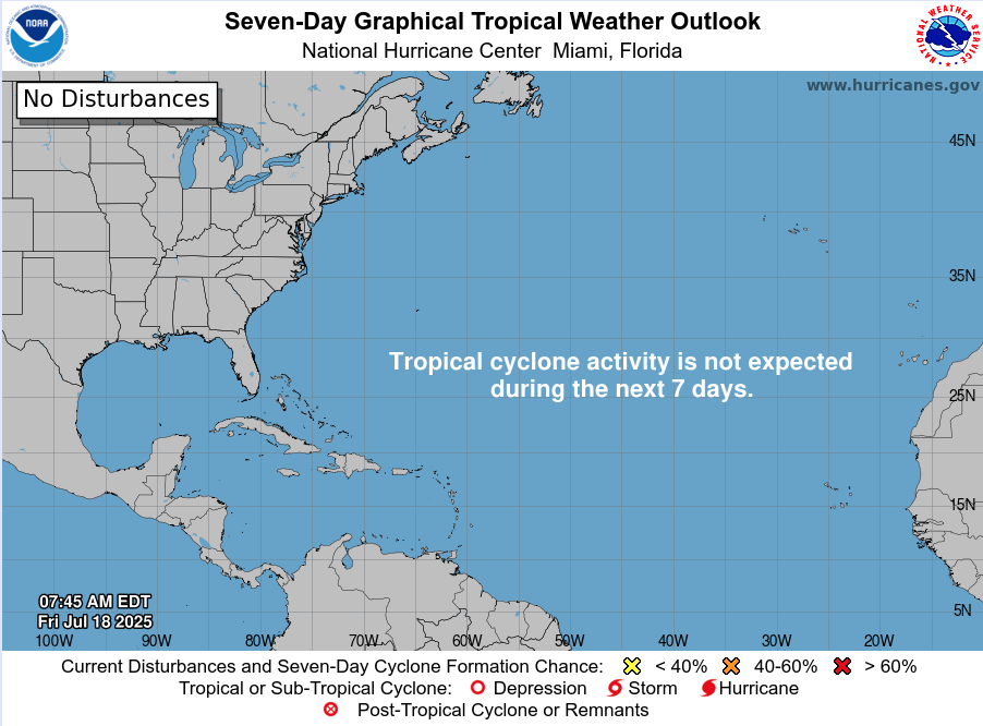
As of this morning’s update from the National Hurricane Center (NHC):
No active tropical cyclones
No named systems or advisories
No tropical development expected over the next 7 days
The basin remains in a holding pattern—but that may change in the weeks ahead.
Satellite imagery courtesy of Windy.com
Sea Surface Temperatures: Running Hot
Ocean heat content continues to build across key development zones:
Gulf of Mexico: Sea surface temperatures (SSTs) remain in the mid-to-upper 80s°F (29–31°C), well above average.
Western Caribbean: Waters continue to warm, supporting deep convection.
Main Development Region (MDR): SSTs between Africa and the Caribbean are approaching thresholds that historically support long-track hurricanes.
These conditions set the stage for rapid intensification when tropical systems do form.
Sea Surface Temperature data courtesy of Windy.com

Wind Shear and Atmospheric Moisture: Becoming More Conducive
While upper-level wind shear remains moderate in parts of the Caribbean and central Atlantic, it is gradually weakening—especially closer to the Gulf. Atmospheric moisture continues to increase:
Mid-level moisture is supporting thunderstorm development
Reduced shear and rising instability create a more supportive environment for potential tropical waves
This combination is worth monitoring as we approach the latter half of July.
Relative Humidity (ECMWF) data courtesy of Windy.com

Wind Shear Courtesy of https://tropic.ssec.wisc.edu/
Saharan Air Layer: A Temporary Shield
Dry air and dust from the Saharan Air Layer (SAL) remain active over the eastern Atlantic:
SAL suppresses convection by drying out the lower atmosphere
It also enhances wind shear, limiting vertical storm growth
This protective layer typically weakens in August
While it currently limits tropical wave development off Africa, its influence is expected to wane soon.
Saharan Air Layer (Dust) data courtesy of Windy.com
Gulf Moisture: Lingering Showers, Low Development Risk
A broad area of low pressure and enhanced moisture remains over the northern Gulf of Mexico:
Development chances remain very low
The system is disorganized, with no surface circulation
Still, heavy rain and localized flooding are possible today along the Gulf Coast, particularly in southern Alabama, the Florida Panhandle, and southeastern Louisiana
This disturbance is more of a rainmaker than a tropical threat but illustrates how even weak lows can impact coastal regions.
Rainfall forecast (ECMWF) courtesy of Windy.com
Florida Forecast: Humid and Storm-Prone
Expect classic July conditions across the state:
North Florida: Highs in the low 90s, partly cloudy, isolated afternoon storms
Central Florida: Around 91°F, muggy, with widespread PM storms
South Florida: Mid-to-upper 80s, very humid, storms possible after 2 PM
Local flooding is possible in poor drainage areas due to repeated rounds of heavy showers.
Thunderstorm forecast (ECMWF) courtesy of Windy.com
Prep Tip of the Day: Review Evacuation Zones
Now is the time to double-check your local evacuation zone and routes:
Know whether you're in a surge or flood-prone area
Identify multiple exit routes in case primary roads are closed
Plan ahead for pets, medication, and transportation
Being familiar with your zone before a storm is one of the best preparedness steps you can take.
Looking Ahead: A Quiet Stretch, But a Shift Is Coming
While the tropics are calm for now, the combination of warming waters, weakening wind shear, and deepening atmospheric moisture signals that a transition to a more active pattern is coming.
Expect activity to increase in late July into early August, as the historical ramp-up in hurricane season begins.
Check back tomorrow for the next update from Cat5Prep.com.