

Atlantic Hurricane Outlook – July 25, 2025: Gulf Disturbance Monitored, Basin Remains Broadly Quiet
Stay updated on the Atlantic hurricane season: July 25, 2025. A weak Gulf disturbance brings rain to Texas & Louisiana, while the broader Atlantic remains quiet with no immediate threats. Prepare now for August!

As we close out the final week of July, the Atlantic basin remains broadly quiet. The only area of interest remains a weak disturbance in the western Gulf of Mexico, which continues to produce showers but shows little sign of organizing. Elsewhere, several tropical waves are making their westward march across the Atlantic, but no significant development is expected in the short term.
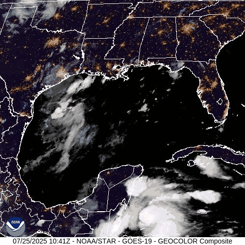
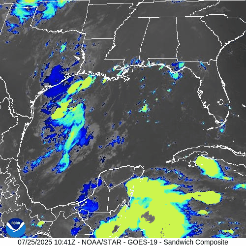
Gulf of Mexico: Weak Trough Brings Rain, Low Development Risk
A surface trough remains draped across the western Gulf of Mexico, generating scattered showers and isolated thunderstorms—particularly offshore of Texas and Louisiana.
The disturbance remains disorganized, with no closed low-level circulation.
Wind shear and surrounding dry air continue to limit development potential.
The National Hurricane Center (NHC) gives this system a low (10%) chance of development over the next 7 days.
However, heavy downpours and localized flooding remain possible across parts of coastal Texas and southwestern Louisiana today.
This weak trough is expected to gradually dissipate as it moves slowly westward.
Atlantic Basin: Multiple Waves, No Immediate Threats
The broader Atlantic remains seasonally active with several tropical waves but no current threats:
Tropical wave near 50°W: Moving westward with scattered convection; not showing signs of organization.
New wave near 23°W, just off the coast of Africa: Tracking westward along the monsoon trough with convection near its southern flank.
A weak low embedded in the monsoon trough near 08N44W is helping spark convection but lacks any closed circulation.
None of these features show signs of imminent development, though they will be monitored closely in the coming days.

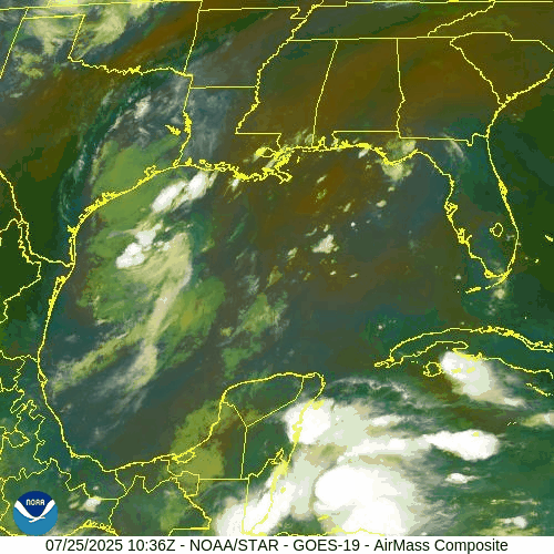
NOAA/NESDIS/STAR – GOES-19 Air Mass Composite – July 25, 2025
Sea Surface Temperatures & Atmospheric Conditions
Sea Surface Temperatures (SSTs) across the Gulf of Mexico and Main Development Region (MDR) remain well above average, supplying ample fuel for tropical development later this season.
Wind Shear remains moderate in the central and western Atlantic, limiting near-term organization.
The Saharan Air Layer (SAL) continues to suppress convection across much of the eastern Atlantic, especially north of the MDR.
Dust & SAL data from Windy.com
Florida Forecast: Typical Summer Pattern
Today’s outlook for Central Florida includes:
Highs in the low 90s°F (32–34°C)
Humidity: High, with heat indices nearing the upper 90s
Rain Chances: Scattered afternoon thunderstorms, driven by sea breeze and daytime heating
Winds: Light and variable, shifting southeast in the afternoon
No tropical impacts are expected for Florida at this time.
Radar imagery courtesy of Windy.com
Prep Tip of the Day: Review Your Evacuation Routes
Use this quiet period to refresh your storm plan:
Know your local evacuation zones
Map out primary and alternate routes
Keep a printed copy in your emergency kit in case power or cell service goes down
Share your plan with family or household members
Looking Ahead: Tropics Likely to Awaken in August
While the Atlantic basin remains quiet for now, the underlying signals—record SSTs, westward-moving waves, and easing shear—suggest a more favorable environment could emerge as we enter August. Stay alert, stay prepared, and keep checking in for daily updates.