Atlantic Hurricane Outlook – September 27, 2025
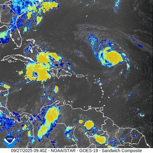
On September 27, Hurricane Humberto has intensified into a powerful Category 4 storm northeast of the Leeward Islands. The hurricane is moving north-northeast, generating swells that will affect the U.S. East Coast but not directly threatening land. Gabrielle is now post-tropical and weakening as it moves away from the Azores. A disturbance near the Caribbean is being monitored for possible tropical storm formation. Florida and the Gulf of America remain quiet, experiencing only routine late-September weather.

Humberto strengthens into a major hurricane; Gabrielle now post-tropical, Atlantic waves watched
Atlantic Basin Overview
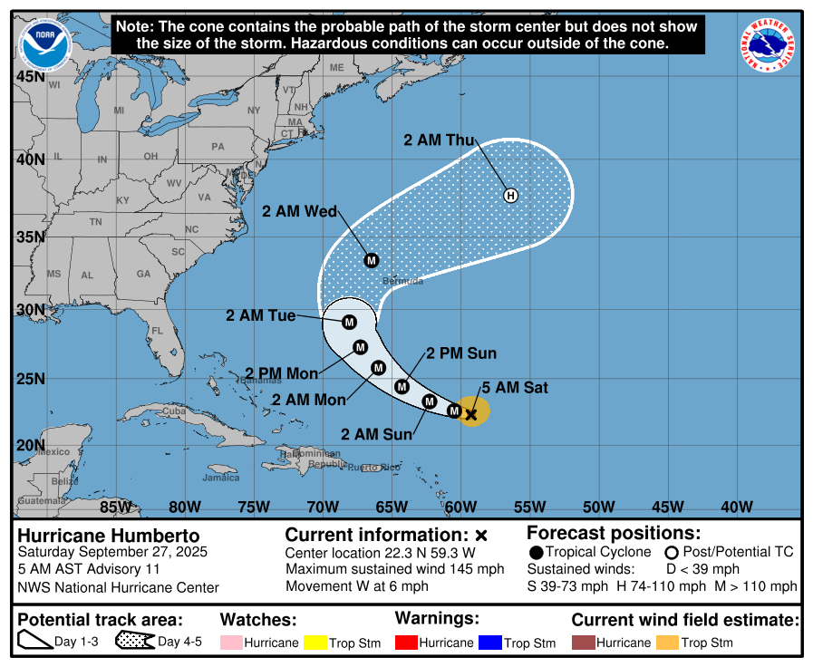
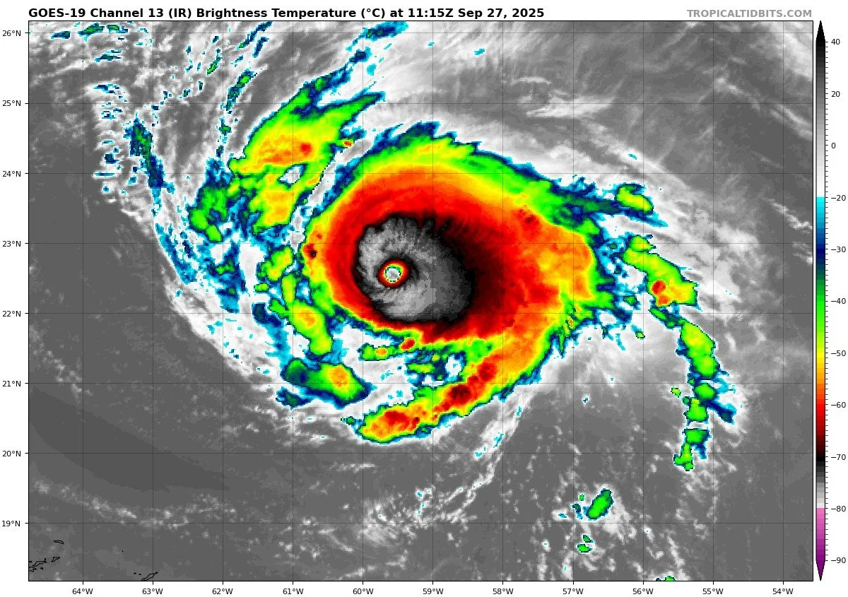
Hurricane Humberto
Humberto has intensified into a Category 4 hurricane, located roughly 390 miles northeast of the northern Leeward Islands. It is forecast to continue accelerating to the north-northeast and curve away from the U.S. East Coast. Some models suggest a possible passage between the U.S. coast and Bermuda later in the week, but confidence is low at this lead time.Gabrielle (Post-tropical)
Gabrielle is now post-tropical and moving away from the Azores toward Portugal. It is gradually losing tropical characteristics, but still producing rough seas and strong winds in its wake.Other Disturbances / Waves
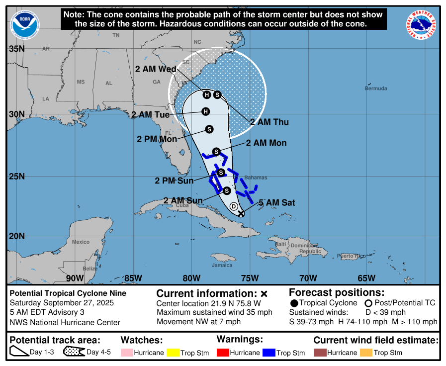
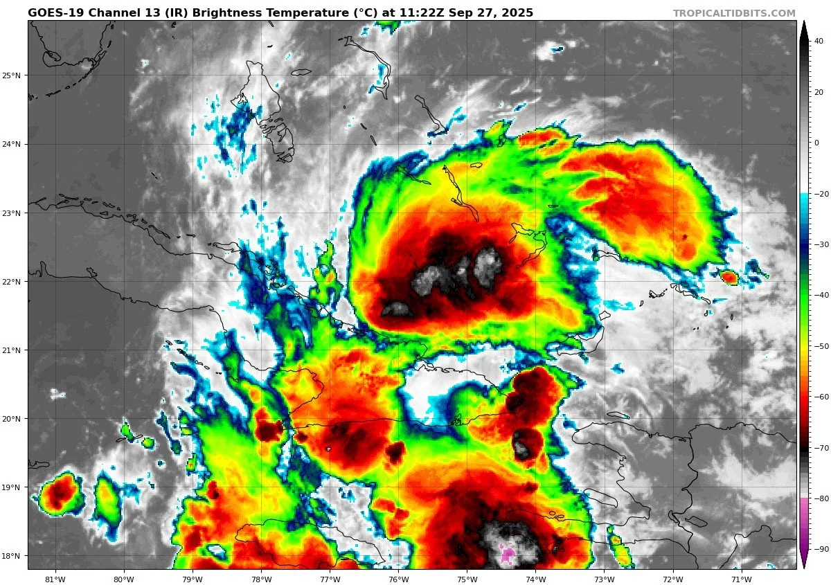
The NHC is monitoring Potential Tropical Cyclone 9 (formerly “Invest 94L”) located near Cuba/dominican region. It is showing signs of organization and may become a tropical storm soon. Forecasts suggest it may pass off the East Coast toward the Carolinas next week.
Hurricane HUMBERTO


Potential Tropical Cyclone NINE


Environmental Conditions
Sea Surface Temperatures (SSTs): SSTs remain warm in the tropical Atlantic, which supports Humberto’s continued strength. Gabrielle is over cooler waters, aiding its decay.
Wind Shear: Humberto is operating in a relatively favorable shear environment, helping it intensify. Gabrielle and other waves are encountering stronger shear, limiting structural maintenance.
Humidity & Dry Air (SAL): Dry mid-level air and Saharan dust remain present, particularly affecting the eastern Atlantic waves and suppressing strong development.
Gulf of America & Caribbean
The Gulf of America and Caribbean remain free of organized systems. Weather is dominated by typical late-September patterns…daily showers and thunderstorms, especially near coasts. No tropical threats currently.
Florida & Eastern U.S. Forecast
Florida is not in the immediate path of either Humberto or the developing wave, and no direct land impacts are expected at this time. The main hazard for the Eastern U.S. coast is continuing dangerous surf and rip currents from Humberto’s swell. Inland, Florida remains hot, humid, and prone to isolated afternoon storms.
Rain forecast visualization courtesy of Windy.com
TL;DR – September 27 Snapshot
Humberto is now a major Category 4 hurricane, heading north-northeast.
Gabrielle is post-tropical and moving away, weakening.
Waters still warm; Humberto favors low shear; dry air limits other systems.
Gulf, Caribbean, Florida remain calm; East Coast watches surf and rip current risk.