
Atlantic Hurricane Outlook – August 15, 2025: Erin Nears Hurricane Strength
Tropical Storm Erin is strengthening and may become the first hurricane of the season this weekend, while Invest 98L in the Gulf delivers heavy rain to South Texas. U.S. land impacts remain limited to surf and rip currents.
TLDR Version, Click Here

Erin Nears Hurricane Strength; Gulf Disturbance Spreads Moisture into Texas; U.S. Coastal Impacts Mostly Marine
Tropical Storm Erin is on the verge of becoming a hurricane—likely the season's first. Meanwhile, Invest 98L in the Bay of Campeche is bringing increased rain chances to South Texas. The U.S. mainland remains free of direct tropical threats, but coastal surf and rip currents from Erin warrant awareness.
Atlantic Basin Overview
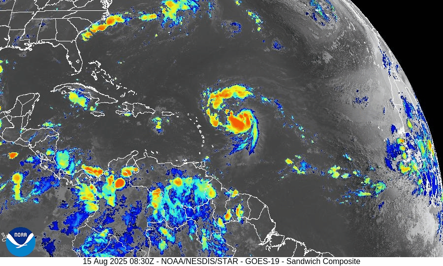
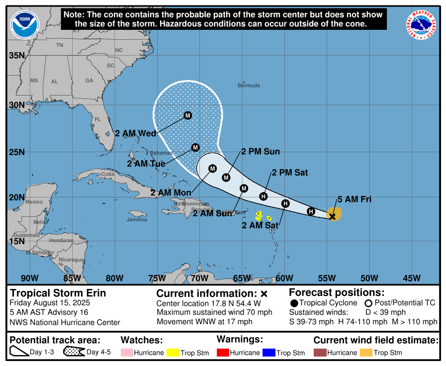
Tropical Storm Erin has intensified, with sustained winds now around 60 mph and tropical storm-force winds extending from a compact core.
Hurricane Hunter aircraft are en route to assess the system. Erin is expected to become a Category 1 hurricane by Friday, with potential escalation to Category 3 (major) over the weekend.Forecast track: Currently on a west-northwest path, Erin is projected to steer northward later and remain offshore of the U.S.–Bahamas corridor, possibly passing near Bermuda. Direct U.S. land impacts are unlikely, but marine hazards will increase.


Gulf of Mexico & Caribbean Conditions
Invest 98L (Bay of Campeche): The disturbance now carries a 40% chance of development over 48 hours and 20% over 7 days. Although tropical cyclone formation is not expected, heavy rain and elevated coastal flooding risk (including rip currents) continue for South Texas.
Caribbean Sea: Stable with typical trade-wind rains and no organized tropical systems.
GOES-19 - Sector view: Gulf of America - Sandwich
GOES-19 - Sector view: Caribbean - Sandwich
Florida & Southeast Forecast
Florida: Persistent heat and humidity prevail with typical afternoon sea‑breeze thunderstorms. These storms are non-tropical in nature.
Marine Impact from Erin: Long-period swells and rip currents will begin affecting East Coast beaches, especially in Florida and the Southeast, as Erin intensifies. Coastal vigilance is advised.
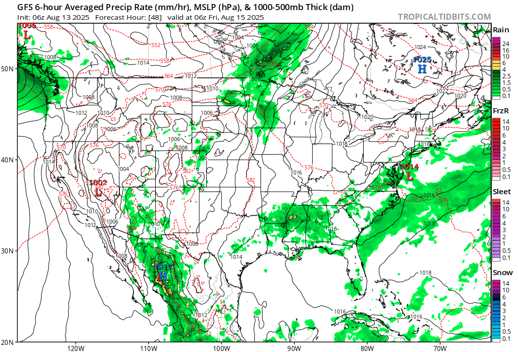
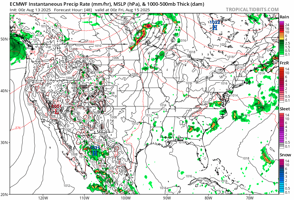
Rain forecast visualization courtesy of Windy.com
Environmental Analysis
Sea Surface Temperatures: Warm—ranging from 84°F to 88°F—support rapid intensification of Erin.
Wind Shear & Atmospheric Moisture: Shear is forecast to decrease and mid-level moisture is sufficient, favoring intensification. Meanwhile, dryness and SAL (Saharan dust) remain more prevalent in other parts of the MDR, limiting additional activity.
Summary & Preparation Notes

Erin is nearing hurricane strength and likely to reach major category. Track keeps it offshore, but surfers and beachgoers should prepare for dangerous surf and rip currents.
Invest 98L will deliver rain to Mexico and South Texas; expect localized flooding.
No immediate threats to Florida or the U.S., but this weekend’s marine hazards are real.
Use this time to confirm emergency plans, especially for any coastal or marine activities.
TL;DR – August 15, 2025
Erin strengthening fast—on track to become a hurricane this weekend.
No direct U.S. impact expected, but surge in surf and rip currents along the Southeast coast.
Invest 98L brings rain to South Texas; low development chances.
Florida sees normal summer weather—hot and stormy, but not tropical.
Coastal watch: Swells and rip current impacts rising; stay informed for Hurricane Updates at CAT5Prep.com
Atlantic Hurricane Outlook – August 13, 2025: Erin Expected to Become 2025’s First Major Hurricane; U.S. Coast Still Unthreatened
Tropical Storm Erin is gaining strength in the Atlantic and could reach major hurricane status this weekend. Forecasts keep it well offshore, but the Southeast coast will see increasing surf and rip currents. Gulf and Florida remain quiet.
A couple disturbances being monitored along with TS Erin
TLDR Version: Click Here
Tropical Storm Erin is continuing its westward progression across the eastern Atlantic, with strong model agreement that it will likely intensify into a major hurricane this weekend. While its path remains well east of the U.S., coastal regions should prepare for elevated surf and rip current risks in the coming days.
Atlantic Basin Overview
Tropical Storm Erin remains steady with sustained winds of 45 mph, moving west at 20 mph.
Forecasts now indicate Erin may become a Category 3 hurricane by Sunday, as environmental conditions improve.
Some models suggest Erin will pass north of the northern Leeward Islands, with a likely northwest turn before reaching the Bahamas—thereby minimizing direct U.S. impacts.
Meanwhile, Invest 96L and other tropical waves remain under observation, but Erin is the dominant system for now.


Gulf of America (Mexico) & Caribbean Conditions
Gulf of America (Mexico): Calm and quiet. Sea surface temperatures are approximately 2°F above average, creating favorable conditions—but without current disturbances.
Caribbean Sea: Trade winds and typical convection dominate. No organized systems at this time.
GOES - GULF - Sandwich - August 13, 2025
GOES - Caribbean - Sandwich - August 13, 2025
Florida & Southeast Outlook
Forecast: Expect hot, humid conditions with typical afternoon sea-breeze thunderstorms. These are non-tropical and not linked to Erin.
Marine Hazards: Elevated surf and dangerous rip currents are becoming a concern along the Southeast coast due to Erin’s offshore activity.
Rain forecast visualization courtesy of Windy.com
Looking Ahead & Preparation
Erin is on track to intensify significantly but should remain well offshore through the weekend.
Continue watching Invest 96L and subsequent waves for potential tropical development.
Residents along the Southeast coast should prepare for marine hazards—not wind or rain threats at this stage.
TL;DR – August 13 Snapshot
Erin is strengthening—expected to become 2025’s first major hurricane.
Forecast track keeps it east of the U.S. mainland.
Gulf and Florida remain calm, with routine summer weather.
Watch for increasing surf and rip current hazards along the Eastern Seaboard.
Stay informed with daily updates on Cat5Prep.

Atlantic Hurricane Outlook – August 12, 2025: Tropical Storm Erin Strengthens; Gulf & Florida Remain Calm
Tropical Storm Erin strengthens in the eastern Atlantic with hurricane potential, while the Gulf of Mexico and Florida remain calm. Here’s today’s August 12, 2025 hurricane update.
TLDR Version; Click Here
Tropical Storm Erin, the fifth named storm of the 2025 season, has formed and is steadily intensifying in the eastern Atlantic. No tropical systems are currently threatening U.S. coastlines, but the atmosphere is becoming more favorable for additional activity later in the week.
Atlantic Basin Summary
Tropical Storm Erin is centered roughly 560 miles west-northwest of the Cabo Verde Islands, moving west at 22 mph with sustained winds near 45 mph. Models suggest Erin could strengthen into a hurricane within the next few days and potentially become the season’s first major hurricane. Forecasters anticipate a gradual curve to the northwest later in the week, keeping land impacts unlikely for now.
While Erin organizes, no other significant systems are expected to develop across the Atlantic this week, though other waves are being monitored as conditions continue to evolve.
GEPS Track Model for TS Erin August 12, 2025
GEFS Track Model for TS Erin August 12, 2025
Gulf of America (Mexico) & Caribbean Conditions
Gulf of America (Mexico): Stable weather with no tropical threats. Sea surface temperatures remain elevated—around 2°F above average in early August —but without supportive atmospheric dynamics for development.
Caribbean Sea: General trade wind flow continues, with only typical convective activity. No organized disturbances are present.
GOES - GULF Sandwich August 12, 2025
GOES - Caribbean Sandwich August 12, 2025
Florida Outlook
Forecast for Today: Expect typical mid-August weather—hot, humid, and afternoons marked with scattered sea-breeze thunderstorms that are inland-driven, not tropical. No storm threats are forecasted for the Sunshine State today.
Rain forecast visualization courtesy of Windy.com
Outlook Summary & Preparation
Erin is likely to become a hurricane, but initial tracks keep it far from U.S. landmasses.
Conditions across other tropical basins are quiet but trending toward increased activity as the season progresses.
Watch and prepare calm: Summer heat and moisture supply are ample—ensuring your supplies and plans are ready strengthens resilience.
TL;DR – August 12 Snapshot
Tropical Storm Erin forming and intensifying; likely to become hurricane/maybe a major one.
No U.S. impacts expected in the near term.
Gulf and Florida calm—just routine summer storms.
Season building toward higher activity later this week.
Stay vigilant and stay updated with Cat5Prep.