Atlantic Hurricane Outlook – September 9, 2025

TLDR Version: Click Here
Atlantic remains unusually quiet during peak season; no tropical development expected
Atlantic Basin Overview
No Active Storms
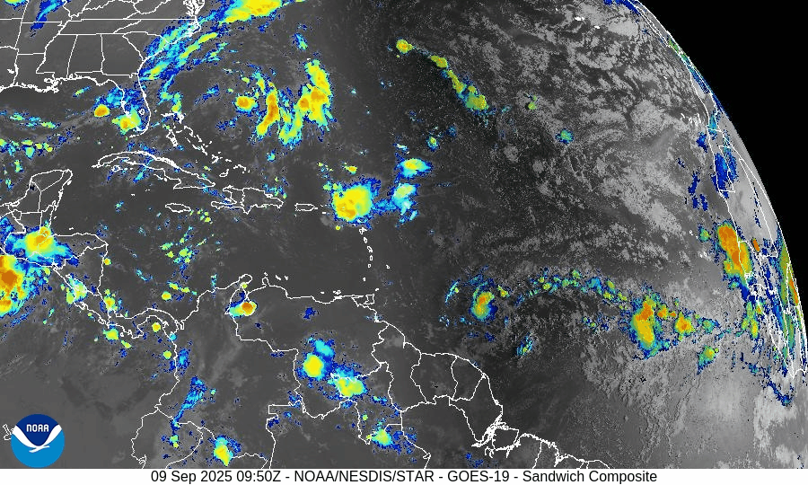
The Atlantic basin continues to be completely quiet. The National Hurricane Center’s latest outlook indicates no tropical cyclone formation is expected in the next 7 days.Tropical Waves
Although a few tropical waves are present, none show signs of sustained convection or development, remaining inactive across the Atlantic. This is stark, given we're in what is normally the most active week of the season.
Environmental Conditions
Sea Surface Temperatures (SSTs): Warm in the Gulf and Caribbean (~29–31 °C), but less conducive further east.
Wind Shear: Elevated shear across the basin continues to suppress tropical formation.
Dry Air & SAL: Persistent dry air and Saharan dust remain widespread, further choking off storm development.
Gulf of Mexico & Caribbean
Conditions remain stable and calm. Only typical afternoon sea-breeze thunderstorms are present along coastal areas. No tropical systems are forecast.
Florida & Southeast U.S. Forecast
Florida continues in its late-summer pattern: hot, humid, with scattered afternoon thunderstorms. With no systems nearby and improving surf conditions, there are no coastal or tropical threats expected this week.

Summary
The Atlantic is fully quiet with no active storms or development expected.
This is unusual for the second week of September, historically known as the Hurricane Season peak.
Environmental conditions remain unfavorable for storm formation: wind shear, dry air, and SAL dominate.
Gulf and Florida remain calm, experiencing only routine weather patterns.
TL;DR – September 9 Snapshot
No storms or development expected; Atlantic remains at rest.
Tropical waves are inactive amid unfavorable conditions.
Environmental factors continue to suppress activity.
Florida and the Gulf stay consistent with typical late-summer weather.