
Atlantic Hurricane Outlook – August 10, 2025: Multiple tropical waves crossing the Atlantic; development chances gaining
Multiple tropical waves are moving across the Atlantic today, but Saharan dust, wind shear, and dry air are keeping development chances low. Warm ocean temperatures could allow for changes later this week.
Atlantic Basin Overview
TLDR Version; Jump Here
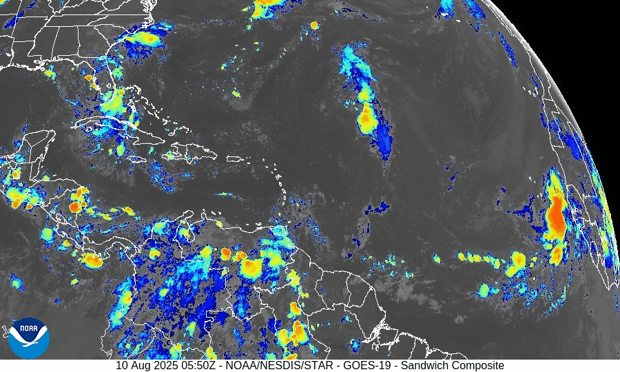
As of this morning, no named tropical cyclones are active in the Atlantic. Several tropical waves are traveling westward across the Main Development Region (MDR), but most are struggling with environmental challenges that limit development. Sea surface temperatures are amply warm, so these waves will continue to be monitored as they move toward more favorable conditions later this week.
Key Systems We’re Watching
Central Atlantic Tropical Wave (~40°W):
Moving west at 10–15 knots with scattered convection. Organization remains limited due to dry air and moderate wind shear. Low chance of development over the next 7 days.Eastern Atlantic Tropical Wave (~23°W, off Africa):
Recently emerged from the continent with convection along its southern flank. Battling Saharan dust and dry air, keeping development chances low in the near term, potentially gaining strength in next 7-days.Monsoon Trough Low (~08N44W):
Embedded within the monsoon trough, sparking intermittent thunderstorm activity. No immediate signs of organized development.
GOES-19 - Sector view: Tropical Atlantic
GFS Future 8/18/25 - Curving NE off Coast of US
Euro Future 8/20/25 - Curving NE off Coast of US
Environmental Conditions
Sea Surface Temperatures (SSTs):
MDR running 28–29.5°C (82–85°F), with 29–31°C (84–88°F) in the Caribbean and Gulf of Mexico—plenty of fuel for storms if other conditions improve.Wind Shear:
Moderate to high shear in the central Atlantic is tilting storm structures and preventing vertical stacking of thunderstorms, slowing development.Moisture:
Humidity is increasing in the western tropical Atlantic, but dry air still lingers across much of the MDR.Saharan Air Layer (SAL):
Dry, dusty air extends across the eastern and central MDR, suppressing convection and capping short-term development potential.
Regional Outlooks
Gulf of Mexico:
No organized tropical disturbances. Typical summer thunderstorms will continue along coastal areas.Caribbean Sea:
Fresh trades persist in the south-central basin with occasional showers. No organized systems.U.S. Southeast & Florida:
Hot and humid with scattered sea-breeze thunderstorms each afternoon. No tropical threats expected today.
GOES-19 - Sector view: Gulf
GOES-19 - Sector view: Caribbean
Looking Ahead (5–10 Days)
The “wave train” from Africa will continue. As SAL weakens and shear pockets relax later this week, one of these waves could encounter a more favorable environment, especially in the central/western MDR.
Prep Reminder
This quiet stretch is the ideal time to review your hurricane plan, restock supplies, and confirm your household communication strategy.
TL;DR – August 10, 2025:
No active storms; several tropical waves in the MDR.
Development chances remain low in the short term due to SAL, wind shear, and patchy moisture.
Warm SSTs mean conditions could turn more favorable later this week. (Chance 70% Dev in next 7-days)
No tropical impacts expected for the U.S. today.