
Atlantic Hurricane Outlook – August 9, 2025: Quiet Tropics with More Waves Brewing
Tropics stay quiet as Invest 96L weakens, but a fresh African wave is gaining attention with a 30% development chance in the next week. Peak season conditions are setting up.
*TLDR Version, Jump Here!
The Atlantic remains calm, but early signs indicate a potential ramp-up in activity. One tropical wave is weakening, while another emerging off Africa is attracting attention due to improving environmental conditions.
Atlantic Basin Overview
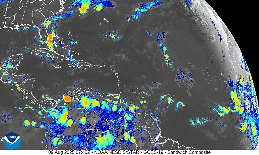
Invest AL96 (Central Atlantic):
The tropical wave associated with AL96 has seen its convection collapse in recent days, largely due to dry, Saharan-influenced air. Development chances remain low at 0–2 days, though gradual organization may become possible in the middle of next week as the system moves northwestward .New African Tropical Wave:
A fresh tropical wave just exiting the African coast has been designated an area of interest. The NHC currently assigns a 30% chance of development over the next 7 days. Long-range models depict a perhaps more favorable environment, suggesting potential development beyond a week and possible impacts in the eastern Caribbean around August 16–17.
Possible hurricane development in the Caribbean newest Tropical Wave. Forecast for around August 20, 2025
Key Environmental Conditions
Seasonal Shift Underway:
Climatologically, the Atlantic heads into its most active phase by mid-August. Increased sea surface temperatures, decreasing wind shear, and waning Saharan dust set the stage for heightened storm activity.
Dust & SAL data from Windy.com
Florida & Coastal Outlook
No threats to land are expected over the next 10 days—including Florida and the continental U.S.—according to current tropical storm patterns and long-range models.
Ripple Effects: Though storm formation is uncertain, increased attention should be paid to rip currents and surf conditions as system trajectories evolve.
Rain forecast visualization courtesy of Windy.com
TL;DR – August 9 Snapshot
Invest 96L: Diminishing convection now, slight development possible later next week.
African wave: 30% chance of forming in 7 days; more model support for mid- to late-August activity.
Environment: Conditions are trending more favorable—very warm waters, less dust, easing shear.
Threat to U.S.: None imminent, but upward trend in activity expected ahead.
Stay alert. Peak season is building fast. Visit CAT5Prep.com for updates.
Atlantic Hurricane Outlook – August 8, 2025: Dexter Is Now Post-Tropical; Invest 96L Gains Strength
Post-Tropical Cyclone Dexter exits the Atlantic, while Invest 96L shows increasing potential for tropical development. Conditions remain favorable with record-warm waters and weakening Saharan dust.
Post-Tropical Cyclone Dexter is moving off into the North Atlantic, fully transitioning into an extratropical system. Meanwhile, tropical wave Invest 96L in the central Atlantic now has a high chance of development, and another system further east offers mid-range development potential.
Atlantic Basin Overview
Dexter has become an expanded, post-tropical storm centered near 41.4° N, 50.4° W
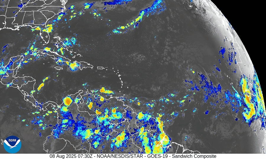
—convection is waning and structure is elongated. (NHC advisory)Invest 96L (tropical wave near ~38° W):
Development chances now stand at 60% within 7 days. Recent observations show disorganized showers, but environmental trends suggest improved potential.New wave along ~38° W with an embedded 1011 mb low around 17° N:
Minimal convection currently, but models indicate conditions may become more favorable later this weekend.
—Chance of development: Low in 48 hours, medium in 7 days.
Environmental Conditions
Sea Surface Temperatures (SSTs): Remain strongly elevated—2–4 °F above average, with localized hotspots reaching 90 °F—offering ample fuel for future storm growth.
Wind Shear: Still moderate to high in the central tropical Atlantic; however, models suggest gradual easing may occur later in the month.
Saharan Air Layer (SAL): Though dust continues to suppress early-season convection, its influence is weakening, particularly in the western basin.
Dust & SAL data from Windy.com
Gulf & Caribbean Update
No tropical activity present.
A high-pressure ridge maintains calm, dry conditions across both regions, with only typical late-summer showers in coastal zones.
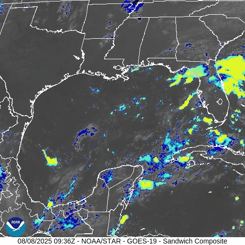
GOES-19 - Sector view: Gulf of America
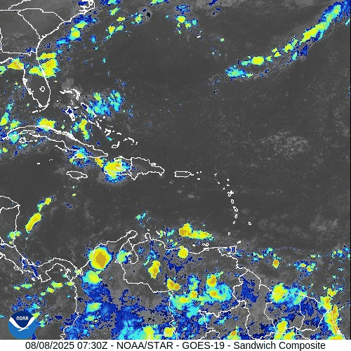
GOES-19 - Sector view: Caribbean
Florida Forecast
Highs: Near 90 °F, with sticky, humid air.
Rain: 40–50% chance of afternoon thunderstorms driven by sea breezes.
Winds: Light and variable; no tropical weather expected.
Rain forecast visualization courtesy of Windy.com
Prep Tip of the Day
With Invest 96L showing increasing organization potential, now is an excellent time to check:
Hurricane supply kits
Evacuation plans
Emergency alert systems across your household
TL;DR – August 8 Snapshot
Dexter has become post-tropical—no land threat.
Invest 96L: 60% chance of development over the next week.
Another eastern wave: Low immediate risk, medium chance in 7 days.
SSTs warm, SAL draining, shear easing—conditions veering toward more activity.
Stay tuned—peak season is ramping up quickly.
For daily updates, stay locked to Cat5Prep.com.

Atlantic Hurricane Outlook – August 7, 2025: Dexter Becomes Extratropical; Invest 96L Watches Intensify
Tropical Storm Dexter is fading, but Invest 96L is strengthening in the Atlantic with a 60% development chance. Meanwhile, another Gulf disturbance lingers. Get the latest real-time update.
Tropical Storm Dexter is nearing its transition into a post-tropical system over the North Atlantic, while a tropical wave designated Invest 96L is gaining strength and has a high potential to develop over the coming days.
Atlantic Basin Summary
Tropical Storm Dexter has sustained winds near 50 mph and is centered around 40.6°N 52.1°W. It's moving east-northeast at approximately 18 mph and is expected to become a strong extratropical low within the next several hours.
Invest 96L, a tropical wave in the eastern Atlantic, now carries a 60% chance of developing into a tropical depression or storm within seven days. It's gaining better organizational structure amidst gradually supportive conditions.
A low-pressure area offshore of the Southeast U.S. retains a 30–40% development chance over the week, but is expected to remain well off the coast and should not pose a land threat.
Key Environmental Conditions
Sea Surface Temperatures (SSTs):
Waters across the Gulf, Caribbean, and Main Development Region remain 2–4°F above average, with locations near southwest Florida reaching nearly 90°F—providing abundant energy for storm formation.Wind Shear:
Wind shear is gradually easing, especially in the central and eastern Atlantic, offering more opportunities for systems like Invest 96L to organize further.Saharan Air Layer (SAL):
Dry and dusty SAL air still suppresses convection across parts of the basin, but its influence may be waning—especially in regions where moisture is increasing.Seasonal Context:
Meteorologists note an uptick in activity as August unfolds, in line with seasonal climatology and current environmental signals including marine heat waves.
Outlook Summary
Tropical Storm Dexter is at the tail end of its life cycle, now transitioning to an extratropical system. The main attention now shifts to Invest 96L, showing increasing potential for development, and a weaker disturbance offshore of the Southeast U.S.—both deserving close monitoring as we move further into the season.
TL;DR – August 7 Snapshot
Tropical Storm Dexter is becoming extratropical and poses no land threat.
Invest 96L carries a 60% chance of development this week.
Another disturbance offshore the Southeast U.S. has 30–40% development odds but remains away from land.
Warm ocean temperatures and easing shear are creating a more favorable environment.
The active season is ramping up—stay prepared and stay tuned.