Atlantic Hurricane Outlook – September 28, 2025
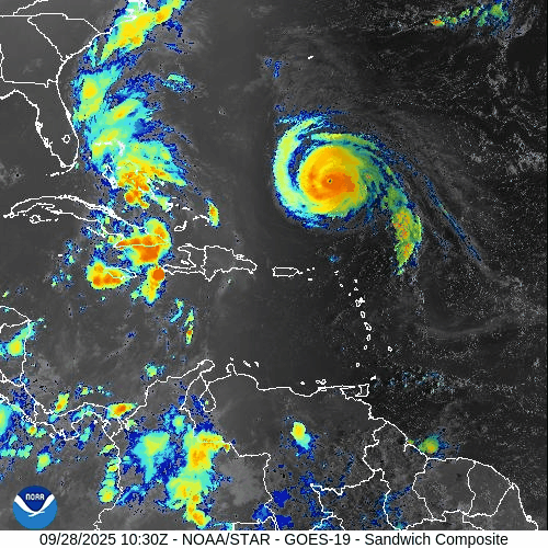
On September 28, Hurricane Humberto remains a strong hurricane in the Atlantic, generating swells along the Eastern Seaboard. Tropical Depression Nine, forecast to become Tropical Storm Imelda, is moving toward the Bahamas and Florida’s east coast, where a tropical storm watch is in effect. Environmental conditions remain supportive with warm SSTs, though wind shear and Saharan dust may slow development. Florida and the Gulf of America should monitor closely.

Humberto remains a powerful hurricane; Tropical Depression Nine intensifying near Bahamas / Florida coast
Atlantic Basin Overview
Hurricane Humberto
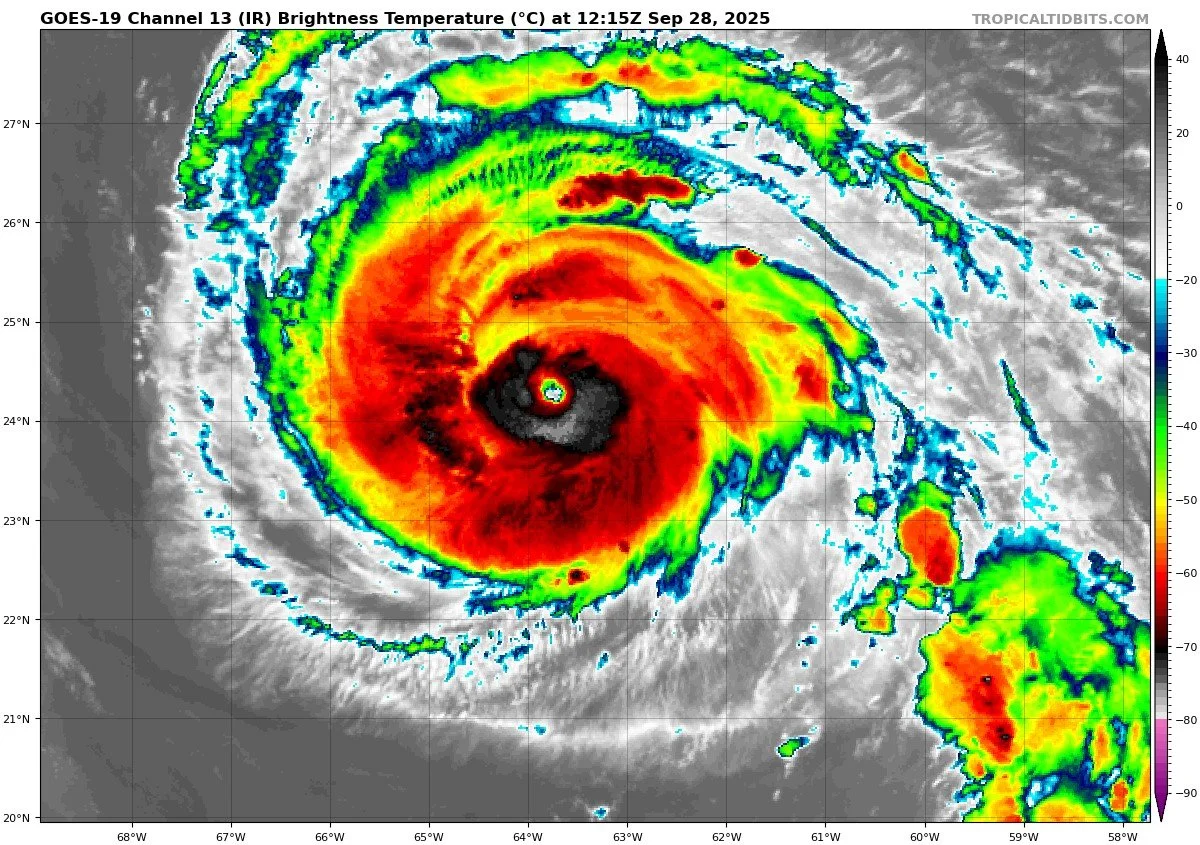
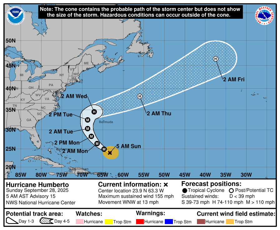
Humberto continues as a major hurricane, with sustained winds estimated near 155 mph after intensifying from Category 5. The storm is located over the southwestern Atlantic and is being monitored for its path.


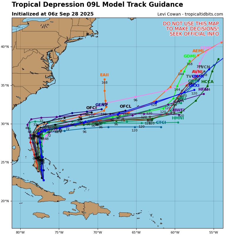
Tropical Depression Nine / Imelda
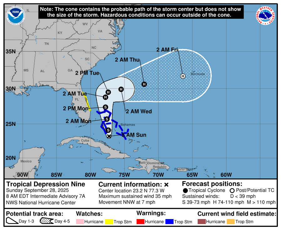
A tropical storm watch has been issued for parts of the east coast of Florida from the Palm Beach/Martin County line to the Flagler/Volusia County line, as the system is expected to strengthen.
The depression is moving slowly north-northwest (~7 mph) and is forecast to cross or approach the Bahamas, then the southeast U.S. coast. It is expected to become Tropical Storm Imelda late today and possibly a hurricane by Monday or Tuesday.


Environmental Conditions
Sea Surface Temperatures (SSTs): SSTs remain warm across the tropical Atlantic and near the Bahamas / Florida coastal zones, supportive of further development for TD Nine / Imelda.
Wind Shear: Humberto is in a relatively low-shear environment that has allowed continued strength. TD Nine / Imelda is expected to encounter moderate shear, which may restrain rapid intensification initially.
Humidity & Dry Air (SAL): Dry mid-level air and influence from the Saharan Air Layer (SAL) remain factors in parts of the Atlantic, which could hinder convection for developing systems.
Gulf of America & Caribbean
The Gulf of America and Caribbean remain largely quiet. No new organized systems currently noted in those basins.

Florida & Eastern U.S. Forecast
Florida’s eastern coast (especially from Volusia northward) is under a tropical storm watch as TD Nine / Imelda strengthens and approaches. Heavy rains, gusty winds, coastal flooding, and rip current threats are possible over the next few days. The broader Eastern U.S. coastline should monitor swells and surf from Humberto. Inland Florida continues with typical humid, afternoon storm patterns.
Rain forecast visualization courtesy of Windy.com
TL;DR – September 28 Snapshot
Humberto continues as a strong hurricane over the Atlantic.
Tropical Depression Nine is expected to become Tropical Storm Imelda, with Florida’s east coast under tropical storm watch.
Warm SSTs favor development; shear and dry air / SAL pose challenges.
Gulf and Caribbean quiet; Florida and Eastern U.S. watching rain, winds, and marine hazards.