
Atlantic Hurricane Outlook – August 2, 2025: Watching Waves, But No Storms Expected
The Atlantic remains calm to start August, with no storms expected this week. A few tropical waves are being monitored, but dry air and wind shear continue to suppress development—for now.
*Those who like data, continue reading. Those it prefer the quick version, jump to the TL;DR here.
As we settle into early August, the Atlantic remains quiet—no active tropical systems and no development forecasted over the next seven days. Although several tropical waves continue moving westward, persistent upper-level wind shear and Saharan dust limit their potential for organization.
Atlantic Basin Summary
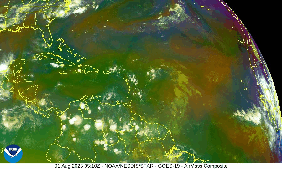
Latest NHC Tropical Weather Scales:
The 8 AM EDT Tropical Weather Outlook confirms no systems expected to form within seven days.
Multiple tropical waves are active:
A wave near 43–50°W with scattered convection.
A new wave moving off Africa near 30°W, gradually tracking westward.
None display organized circulation or development potential at this time.
Satellite imagery provided by Windy.com
Environmental Conditions
Sea Surface Temperatures (SSTs):
29–31 °C (84–88 °F) across the Gulf of Mexico and Caribbean.
MDR temperatures remain slightly above average, offering rising energy for late-season storms.
Wind Shear:
Still moderate to high across much of the basin, inhibiting vertical growth.
Saharan Air Layer (SAL):
Thick dry air layer continues across most of the MDR, suppressing convection and storm development.
Atmospheric Moisture:
Gradually increasing in the western Atlantic and Caribbean—monitoring for signs of improved convective support.
Gulf of America (Mexico) & Caribbean Region
No disturbances currently monitored.
A dominant high-pressure ridge maintains light winds and calm seas.
Scattered showers along Florida’s west coast remain typical summer moisture—not tropical in origin.
Radar imagery courtesy of Windy.com
Florida Forecast
Highs: Upper 80s to low 90s °F with high humidity.
Rain Chances: 40–50% for scattered afternoon thunderstorms due to seabreeze convergence.
Winds: Light and variable.
No tropical threats expected in Florida today.
Rain forecast visualization courtesy of Windy.com
Seasonal Outlook
The Atlantic season to date includes three named storms (Andrea, Barry, and Chantal), but lacks any hurricanes—a below-average ACE, echoing early-season inactivity last seen in 2009.
NOAA and CSU continue to forecast above-average hurricane activity overall, with 13–19 named storms and 6–10 hurricanes anticipated this season.
August typically marks the ramp-up of tropical activity, especially across the MDR and Gulf of Mexico, where conditions may become more favorable by mid-month.
Prep Tip of the Day: Verify Your Alert Setup
Now is a good time to:
Confirm you’re registered with local emergency alert systems.
Test NOAA weather radios and app notifications.
Re-check family communication plans and emergency kit locations.
Looking Ahead
While the forecast remains calm now, early August often brings the first major shifts in seasonal activity. Keep tracking tropical waves as they approach warmer waters and potentially lower shear environments.
TL;DR – August 2, 2025 Hurricane Summary
No active storms or developing systems in the Atlantic.
Several tropical waves are present but remain weak and disorganized.
High wind shear and Saharan dust continue to suppress development.
Sea surface temperatures are high and rising.
Historical patterns suggest increased activity may begin in mid‑August.
Stay prepared and stay informed with daily updates from Cat5Prep.com.