Atlantic Hurricane Outlook – September 24, 2025
On September 24, Hurricane Gabrielle is a powerful Category 3 storm moving east-northeast toward the Azores, where a hurricane warning is in effect. While no direct landfall is expected in the U.S., Gabrielle’s swells are producing dangerous surf and rip currents along the East Coast. Other Atlantic disturbances remain suppressed by wind shear, dry air, and Saharan dust. Florida and the Gulf of America remain calm, experiencing only late-summer heat, humidity, and afternoon thunderstorms.

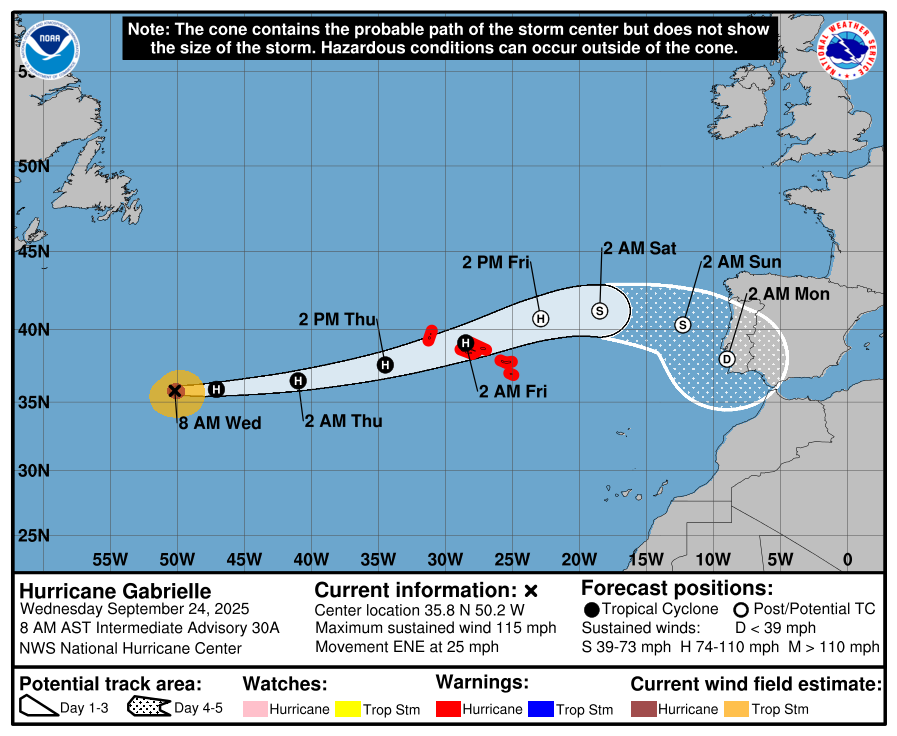
Gabrielle weakens slightly but remains a major hurricane as it approaches the Azores; East Coast seas stay rough
Atlantic Basin Overview
Hurricane Gabrielle
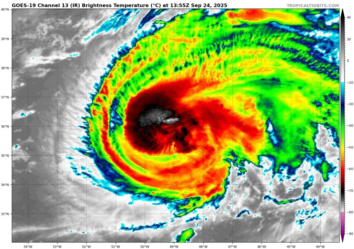
Gabrielle is now a Category 3 hurricane with maximum sustained winds near 115 mph. It is centered at 35.8° N, 50.2° W, moving east-northeast at about 25 mph. The storm is expected to weaken gradually as it encounters cooler waters, but it remains dangerous. A hurricane warning is in effect for the Azores, where Gabrielle will pass over or very near the islands late Thursday into Friday.Swells from Gabrielle continue to spread westward, producing life-threatening surf and rip currents across Bermuda, the U.S. East Coast from the Carolinas through New England, and into Atlantic Canada.
Other Waves / Disturbances
The NHC is monitoring additional tropical waves across the Atlantic. None are currently well-organized, and environmental conditions are limiting immediate development. Forecast guidance suggests these waves are not a threat to the Eastern U.S. coastline in the near term.


Environmental Conditions
Sea Surface Temperatures (SSTs): SSTs beneath Gabrielle remain warm enough to support a major hurricane, but cooler waters lie ahead along its northeastward track, which will drive weakening in the coming days.
Wind Shear: Vertical wind shear is beginning to increase, disrupting Gabrielle’s inner core and capping further rapid strengthening. The eastern Atlantic waves are also encountering moderate to high shear, preventing better organization.
Humidity & Dry Air (SAL): Pockets of mid-level dry air and dust from the Saharan Air Layer are feeding into parts of Gabrielle’s circulation and heavily suppressing convection for the monitored waves farther east. This continues to be a key factor in limiting new development.
Gulf of America & Caribbean
The Gulf of America and Caribbean remain quiet, with no signs of tropical organization. Only routine late-September showers and thunderstorms are expected.
Florida & Eastern U.S. Forecast
Florida faces no direct tropical threats. The broader Eastern U.S. coastline is not in Gabrielle’s path, but dangerous surf and rip currents will continue along Atlantic beaches this week. Florida itself remains in a late-summer pattern of hot, humid conditions with scattered afternoon thunderstorms.
Dust data courtesy of Windy.com

Summary
Gabrielle is a Category 3 hurricane, expected to weaken as it nears the Azores.
The storm is producing hazardous swells and rip currents across the Western Atlantic, including along the U.S. East Coast.
Environmental factors: warm SSTs still support Gabrielle, but increasing shear, cooler waters, and SAL-driven dry air are forcing gradual weakening.
The Gulf of America, Caribbean, Florida, and Eastern Seaboard remain free of direct tropical threats, aside from marine hazards.
TL;DR – September 24 Snapshot
Gabrielle: still a powerful Cat 3, moving toward the Azores.
Dangerous surf/rip currents along the East Coast.
Other Atlantic waves remain weak; no U.S. land threats.
Environmental factors shifting toward weakening: cooler SSTs, higher shear, dry air.
Florida & Gulf stay calm aside from routine storms.