Atlantic Hurricane Outlook – September 13, 2025
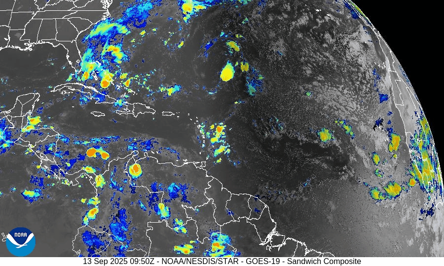
On September 13, the Atlantic basin remains storm-free, with no tropical cyclones currently active. A tropical wave between Africa and the Cabo Verde Islands is producing showers and thunderstorms but faces limited short-term development potential due to dry air and wind shear. The Gulf of Mexico and Florida remain calm, experiencing only the usual heat, humidity, and afternoon storms of late summer.

Atlantic basin quiet; tropical wave off Africa flagged, but development odds remain modest
Atlantic Basin Overview
No Active Tropical Cyclones
There are currently no tropical storms, hurricanes, or depressions in the Atlantic, Gulf of Mexico, or Caribbean. The NHC confirms the basin is calm with no active systems.Tropical Wave Near Africa / Cabo Verde Islands
A tropical wave located between the west coast of Africa and the Cabo Verde Islands is producing some showers and thunderstorms. It’s being monitored. Environmental conditions (dry, stable air) are expected to limit development over the next few days, though a tropical depression could form by the middle to latter part of next week, moving west-northwestward at ~10-15 mph.
Environmental Conditions
Sea Surface Temperatures (SSTs): Warm in the Caribbean and Gulf (~29–31 °C), but the far eastern Atlantic faces somewhat cooler and less supportive SSTs for strong development.
Wind Shear: Moderate to strong upper-level wind shear persists, especially over the regions east of the tropical wave, making rapid intensification unlikely.
Dry Air & Saharan Air Layer (SAL): Significant dry and stable air, partly from the SAL, remains present over much of the eastern and central Atlantic — this is suppressing convective organization in the tropical wave.
Gulf of (America) Mexico & Caribbean
Both regions remain calm under high pressure. Only typical afternoon sea-breeze thunderstorms are occurring. There are no disturbances showing signs of organization in the Gulf or Caribbean.
Florida & Southeast U.S. Forecast
Florida continues with late-summer conditions: hot, humid, with scattered afternoon showers and thunderstorms. With no nearby tropical systems, there are no tropical threats or enhanced coastal risks at this time. Marine conditions are benign.
Rain forecast visualization courtesy of Windy.com

Summary
Atlantic basin remains inactive; no active systems.
A tropical wave off Africa is being monitored; development is possible later in the week but odds are modest and hindered by dry air and shear.
Environmental conditions are generally unfavorable for strong or rapid development in the near term.
Gulf, Caribbean, and Florida see only routine seasonal weather—no tropical threats.
TL;DR – September 13 Snapshot
Atlantic quiet—no storms active.
Tropical wave near Africa has potential but low short-term chances.
Dry air, SAL, and shear continue to suppress activity.
Florida & Gulf remain calm, with typical heat and scattered storms.