
Atlantic Hurricane Outlook – October 6, 2025
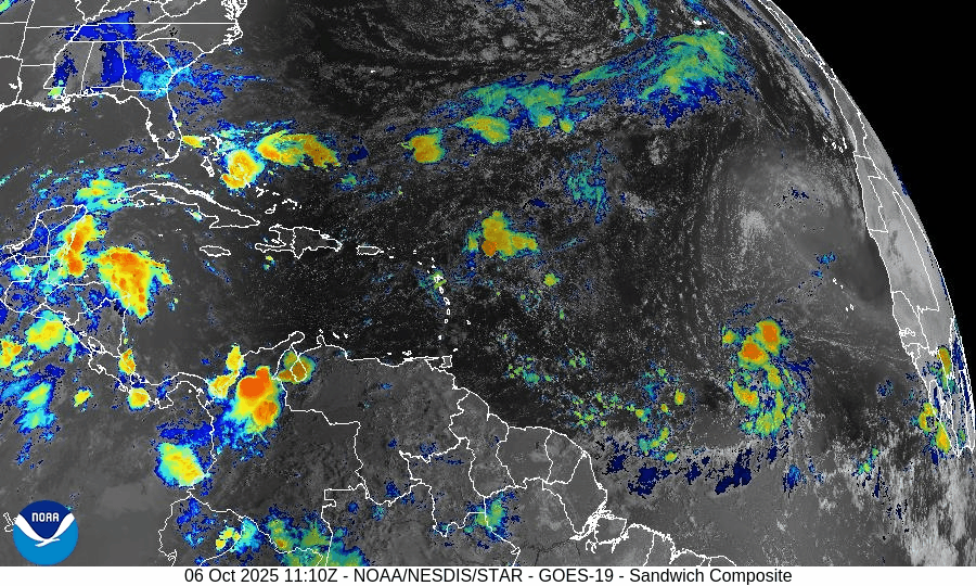
On October 6, a tropical disturbance in the central Atlantic maintains a 70% chance of development according to the National Hurricane Center. The system remains disorganized but is moving through warm waters conducive to gradual formation. Environmental factors like dry air and moderate wind shear are slowing intensification. Florida and the Gulf of America remain free of direct tropical threats.

No active tropical systems; a disturbance in the central Atlantic bears watching
Atlantic Basin Overview
No Active Tropical Cyclones
Currently there are no named storms or hurricanes in the Atlantic, Caribbean, or Gulf of America per the latest NHC outlook.Disturbance Under Monitoring
The NHC continues to track a tropical wave / disturbance in the central Atlantic with increasing organization and favorable parameters. This system retains a 70% chance of tropical development over the next 7 days as earlier reported.
Environmental Conditions
Sea Surface Temperatures (SSTs):
SSTs across much of the tropical Atlantic and the disturbance’s projected path remain warm, generally supportive for development if other conditions align.Wind Shear:
Elevated vertical wind shear remains a limiting factor across broad parts of the Atlantic. That shear may slow intensification or disrupt organization of the monitored disturbance.Humidity & Dry Air / SAL:
Mid-level dry air and Saharan dust intrusions persist in portions of the basin. Those dry air inclusions and SAL effects continue to suppress convective vigor in developing systems, especially farther east.
Gulf of America & Caribbean
The Gulf of America and Caribbean basins remain quiet. No tropical systems are forming at present; convection is limited to normal seasonal showers and thunderstorms.
Florida & Eastern U.S. Forecast
Florida and the Eastern U.S. are currently not under direct tropical threat. The disturbance is positioned well east of the region. The main concern along the Atlantic coast continues to be elevated surf, swells, and rip current risk, especially if the disturbance develops and enhances ocean motion.
Rain forecast visualization courtesy of Windy.com

TL;DR – October 6 Snapshot
No active storms at the moment.
A central Atlantic disturbance holds a 70% 7-day development chance.
SSTs are favorable; shear and dry air are still challenges.
Gulf of America and Caribbean are quiet.
Florida/Eastern U.S.: no direct threat; marine conditions (surf/rip currents) remain the main hazard.