
Atlantic Hurricane Outlook – August 31, 2025
On August 31, the Atlantic remains storm-free following the dissipation of Fernand and Erin’s exit. The only feature of interest is a tropical wave moving off Africa, with a low 30% development chance over the next 7 days. Environmental conditions—wind shear, dry air, and Saharan dust—continue to limit storm formation. Florida and the Gulf remain calm aside from typical summer storms.

TLDR Version: Click Here
Atlantic basin remains quiet; a weak wave off Africa shows low (30%) development odds
Atlantic Basin Overview
No Active Storms
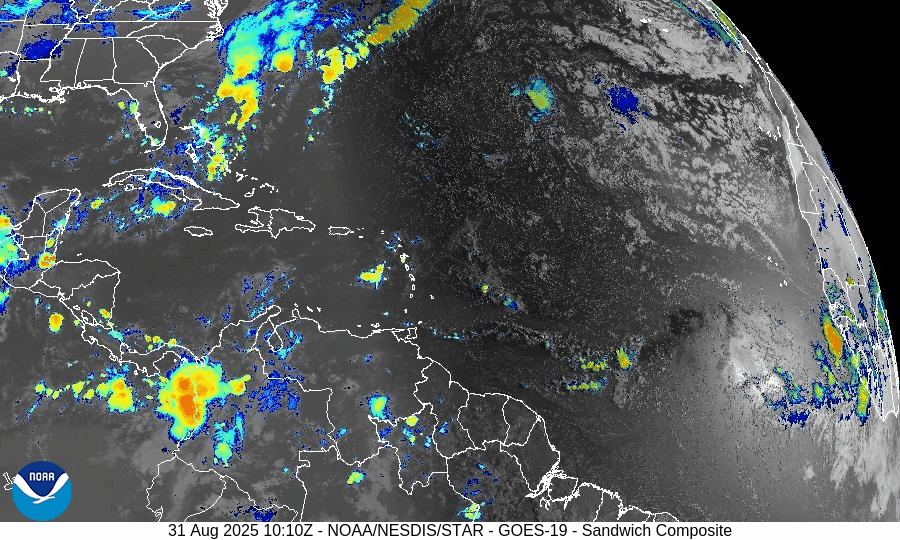
There are currently no active tropical cyclones in the Atlantic basin. The calm continues following Fernand’s dissipation and the end of Erin’s impacts.Tropical Wave Near Africa
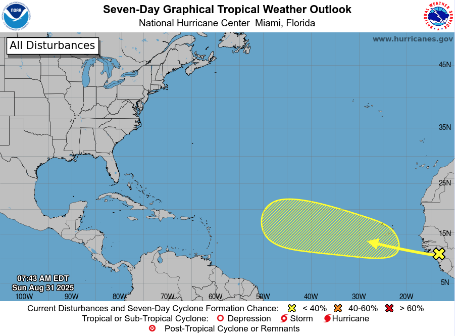
A tropical wave is forecast to emerge off the west coast of Africa, and the NHC assigns it a low – but not negligible – chance of development: 0% over the next 2 days, increasing to 30% over the next 3 to 7 days.
Environmental Conditions
Sea Surface Temperatures (SSTs): Warm in the Caribbean and Gulf (~29–31 °C), but less favorable conditions in much of the open Atlantic.
Wind Shear: Continues to be elevated across large swaths of the basin, discouraging storm formation.
Mid-Level Humidity & SAL: Dry air and Saharan dust (SAL) remain prevalent, further suppressing convective activity.
Gulf of Mexico & Caribbean
The Gulf remains quiet and stable, dominated by high pressure. Only routine afternoon thunderstorms are occurring along the coasts—no tropical development is expected.
Florida & Southeast U.S. Forecast
Florida continues in its late-August pattern—hot, humid, with scattered afternoon thunderstorms. No tropical threats are present.
Beaches along the Atlantic coast are beginning to calm. With no new swells incoming, rip currents and surf conditions are generally improving, though caution remains prudent in areas still unsettled from earlier systems.
Rain forecast visualization courtesy of Windy.com
Summary

Atlantic basin is currently calm, with no tropical storms or hurricanes active.
A new tropical wave off Africa carries low (30%) development odds over the next week.
Environmental factors (cooler SSTs, shear, dry air, and SAL) continue to limit development potential.
Gulf and Florida remain storm-free, apart from the usual summer thunderstorms.
TL;DR – August 31 Snapshot
The Atlantic is quiet and free of active storms.
A wave off Africa has low (30%) chance of development by next week.
Environmental conditions remain unfavorable for new formations.
Florida and Gulf remain calm with only routine seasonal storms.
