
The Coastal Resident's Playbook: Navigating Hurricane Season with the Right Tools (2025 Edition)

Living along the coast—in states like Florida, Texas, Louisiana, and the Carolinas—means embracing the beauty of oceanfront life while staying prepared for the realities of hurricane season. As the 2025 Atlantic hurricane season begins on June 1, true peace of mind comes not from luck, but from preparation.
In the digital age, readiness starts with the right online resources. This guide highlights the most reliable websites and weather apps that every coastal resident should have bookmarked or downloaded. Whether you’re monitoring a storm system in the Atlantic or preparing for a direct hit, these tools will keep you informed and ahead of the storm.
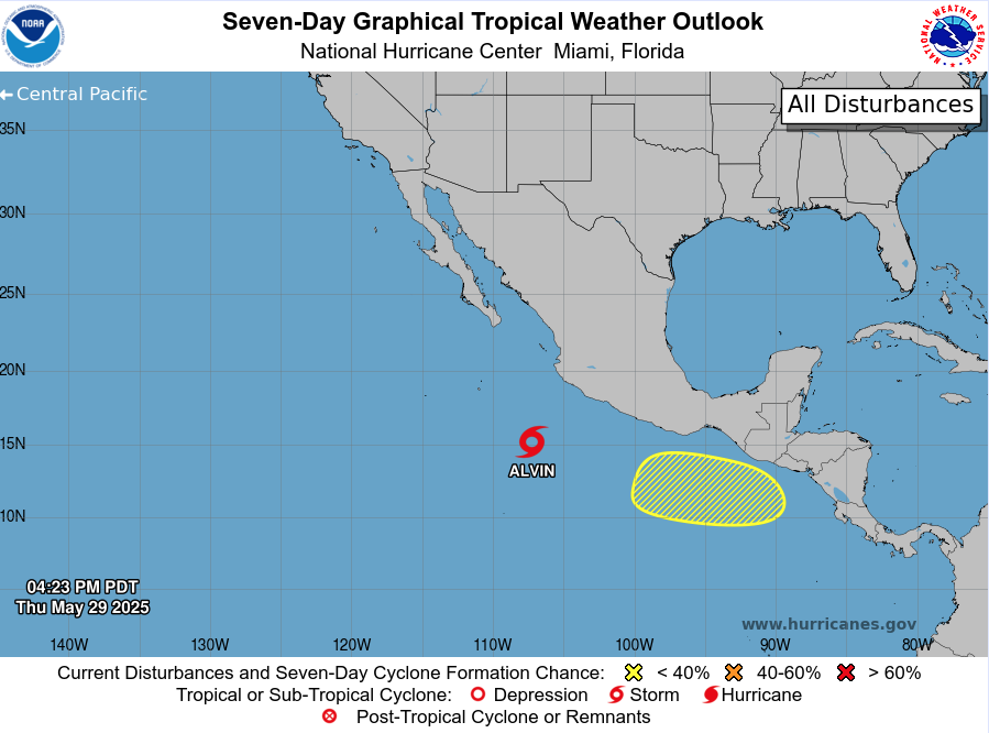
1. National Hurricane Center (NHC)
Website: www.nhc.noaa.gov
Cost: Free
The National Hurricane Center is the official source for hurricane forecasts, watches, and warnings. It's where emergency managers and meteorologists turn for accurate storm data.
Key Features:
Real-time tropical storm and hurricane advisories
“Cone of Uncertainty” tracking maps
Forecast discussions written by meteorologists
Storm surge and wind speed probability graphics
Why it matters: This is the most authoritative source of hurricane data for the U.S. and Caribbean.
2. Windy
Website: www.windy.com
App Available: iOS & Android
Cost: Free; Pro version available for $29.99/year
Windy delivers stunning weather visualizations that let you track storm systems across the globe with interactive maps.
Highlights:
Multiple forecast models: ECMWF, GFS, ICON
Real-time wind, pressure, and precipitation overlays
Custom alerts and detailed forecasts
Ideal for: Visual learners and weather enthusiasts who want to see how weather systems develop.
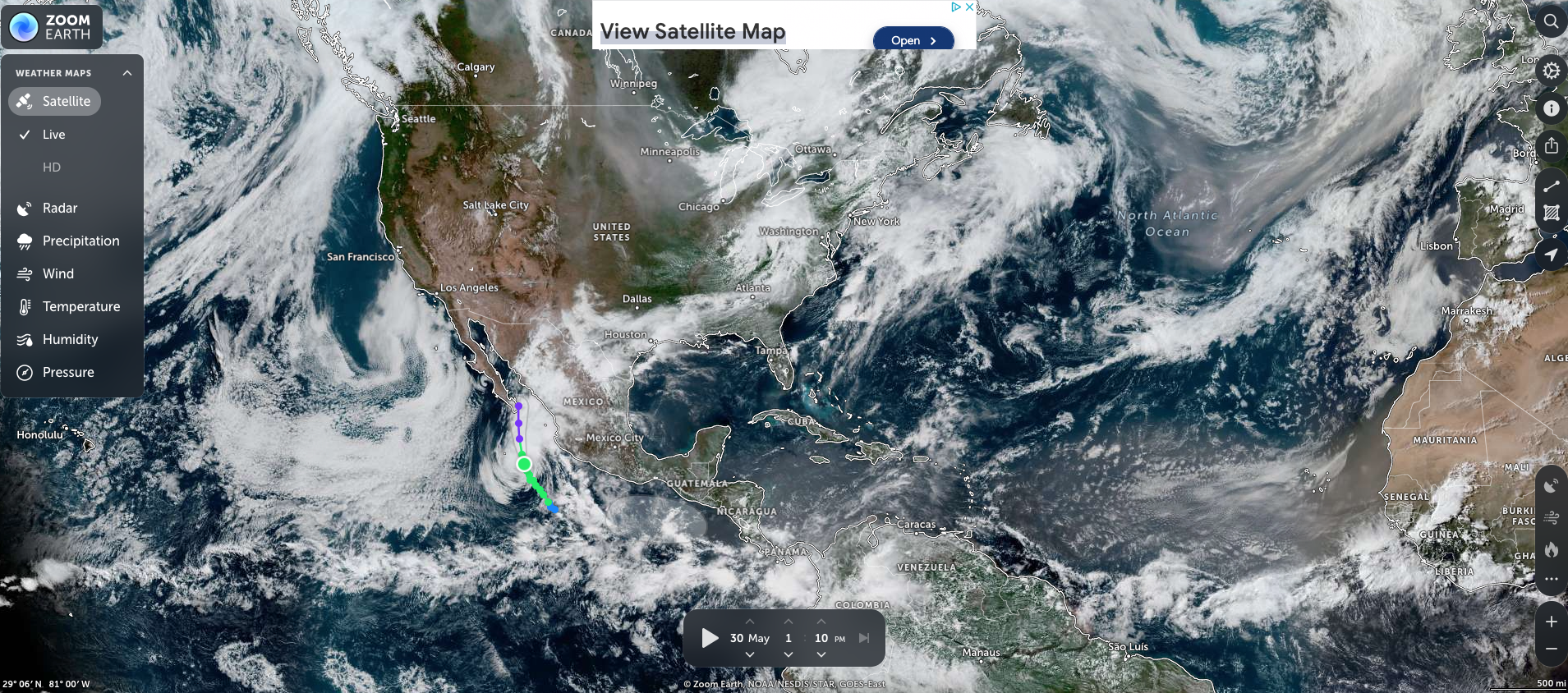
3. Zoom Earth
Website: www.zoom.earth
Cost: Free
Zoom Earth provides live satellite imagery and storm tracking with an easy-to-use interface.
What you’ll find:
Live storm satellite loops
Active tropical systems and forecast paths
Wind, temperature, and radar overlays
Best for: A quick visual confirmation of storm activity and movement.
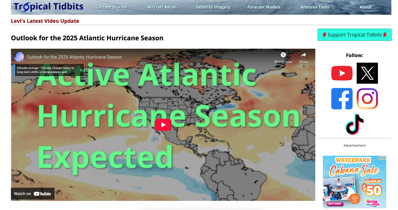
4. Tropical Tidbits
Website: www.tropicaltidbits.com
Cost: Free
Created by meteorologist Levi Cowan, Tropical Tidbits offers educational insights into tropical weather with a deep dive into forecast models.
Top Features:
GFS, ECMWF, and ICON model loops
Infrared and water vapor satellite imagery
Daily tropical outlook videos
Why it’s useful: It helps explain why a forecast looks the way it does—great for curious minds.
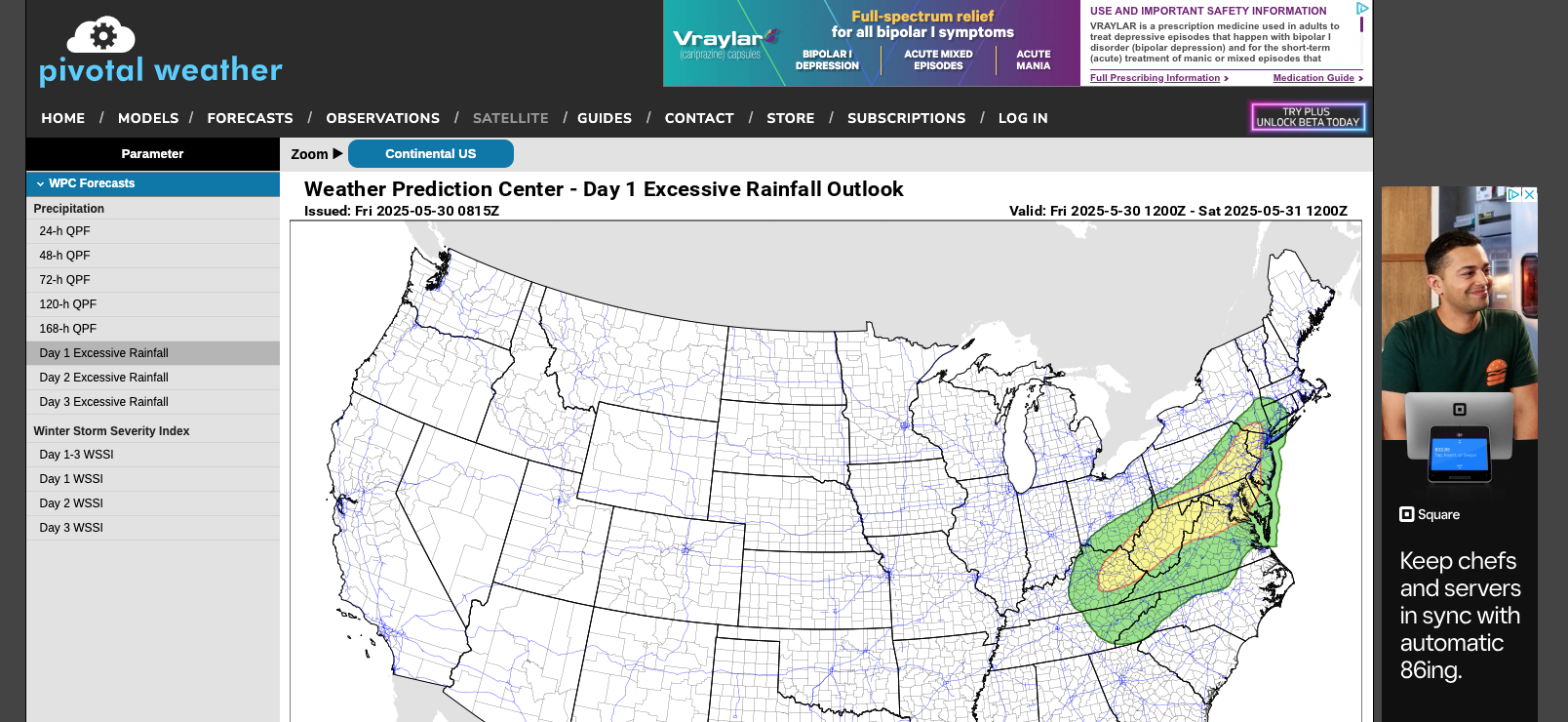
5. Pivotal Weather
Website: www.pivotalweather.com
Cost: Free
Pivotal Weather offers advanced weather model tools for tracking severe weather, including hurricanes.
Key Tools:
Spaghetti models and ensemble forecasts
CAPE, wind shear, and pressure overlays
Tools for interpreting storm structure and strength
Perfect for: Advanced users, storm chasers, and amateur meteorologists.
6. MyRadar
App Available: iOS & Android
Cost: Free with optional upgrades
MyRadar is a fast and intuitive weather app featuring high-resolution radar imagery and storm tracking.
Standout Features:
Real-time radar with hurricane overlays
Custom weather alerts for your area
Fire, wind, and earthquake tracking
Great for: Everyday users and emergency readiness.
7. RadarScope
App Available: iOS & Android
Cost: $9.99/year (Basic); $14.99/year (Pro Tier 1)

Some of our favorite apps for Hurricane and Daily use
RadarScope is the go-to app for meteorologists and weather professionals who need detailed radar data.
Features Include:
NEXRAD radar access and velocity scans
Tornado, hail, and wind shear detection
Direct connection to U.S. radar stations
Recommended for: Users with a strong interest in severe weather analysis.
8. The Weather Channel App
App Available: iOS & Android
Cost: Free with ads; premium available
A trusted name in weather, this app delivers both everyday forecasts and in-depth storm coverage.
Benefits:
Hourly and 10-day forecasts
Severe weather and hurricane alerts
Live streaming video during major weather events
Good for: Daily use and reliable hurricane alerts.
9. Windy.app
App Available: iOS & Android
Cost: Free with Pro version available ($24.99/year)
Windy.app is tailored to sailors, surfers, and boaters but includes powerful storm tracking features for coastal residents.
What’s inside:
Wind and wave forecasts by location
NOAA alerts and radar integration
Real-time storm updates
Use case: Outdoor and marine safety before, during, and after hurricanes.
10. NOAA Weather Radar Live / NOAA Now

App Available: iOS & Android
Cost: Free with in-app upgrades
These apps provide direct access to NOAA data with an easy-to-use interface.
App Features:
Live radar maps
National Weather Service alerts
Forecasts and emergency info
Why it matters: You’re getting official government warnings in real time.
Bonus Apps & Tools to Explore:
Storm Radar – Advanced storm tracking with detailed overlays
Ventusky – Smooth, interactive visuals of wind and weather
FishWeather / SailFlow – Specialized marine and coastal forecasts
Final Tips: Stay Prepared with the Right Tools
Being prepared for hurricane season doesn’t stop with bottled water and batteries. Information is your most valuable asset during a storm.
What to do now:
Bookmark the National Hurricane Center for official updates
Download Windy or Zoom Earth for visual storm tracking
Set up alerts in MyRadar or The Weather Channel app
Explore RadarScope or Tropical Tidbits for deeper insights
Create a dedicated folder on your smartphone labeled “Hurricane Tools” so you’re ready to act quickly when a storm is on the horizon.
Stay alert. Stay informed. Stay safe.

*We may earn a commission from purchases made through links on this page, including Amazon.com.