
Atlantic Hurricane Outlook – September 11, 2025
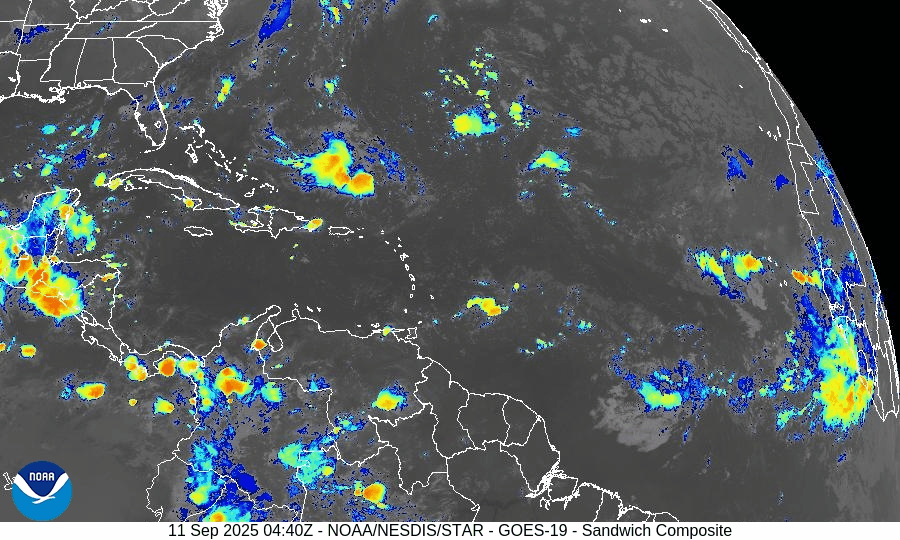
On September 11, the Atlantic basin remains storm-free with no active cyclones. A tropical wave emerging off the coast of Africa has been given a 30% chance of development over the next 7 days, though environmental conditions such as wind shear, dry air, and Saharan dust remain unfavorable. The Gulf of Mexico and Florida stay calm, experiencing only typical late-summer thunderstorms.

Atlantic remains calm; weak tropical wave off Africa flagged with low chance (30%) of development over 7 days
Atlantic Basin Overview
No Active Tropical Cyclones
The Atlantic basin, including the Caribbean Sea and Gulf of Mexico, currently has no active tropical storms, hurricanes, or depressions. The NHC outlook confirms no formation expected in the near term.Tropical Wave Off Africa
A tropical wave is forecast to emerge offshore of West Africa by Friday. It will travel west to west-northwest at about 15 mph, over the eastern and central tropical Atlantic. Although conditions may allow for some gradual development, the NHC gives this wave a low chance (near 0%) over the next 48 hours, increasing to 30% over the next 7 days.
Environmental Conditions
Sea Surface Temperatures (SSTs): Warm in the Gulf and Caribbean (29–31 °C), supportive for storm formation there—but in the eastern tropical Atlantic, SSTs are marginal or just adequate for potential development.
Wind Shear: Moderate to high shear persists across much of the Atlantic, making rapid development unlikely.
Dry Air & Saharan Air Layer (SAL): Dry mid-level air and SAL remain strong headwinds for storm formation, especially for any tropical waves nearing the eastern Atlantic.
Gulf of America (Mexico) & Caribbean
Conditions remain quiet and stable. Only routine afternoon thunderstorms are expected along coastal areas, with no tropical system showing signs of organization.
Florida & Southeast U.S. Forecast
Florida continues in its typical early-September weather pattern—hot, humid, and marked by scattered afternoon thunderstorms. With no active systems in the Atlantic, Gulf, or nearby, there are no coastal or tropical threats expected in the short term. Surf and marine conditions are generally benign.
Rain forecast visualization courtesy of Windy.com

Summary
Atlantic is quiet with no active tropical storms.
Weak tropical wave off Africa has ~30% chance of development in 7 days; 0% in the next 48 hours.
Environmental factors (SSTs, shear, dry air/SAL) remain mostly unfavorable.
Gulf and Florida remain calm with routine summer convection.
TL;DR – September 11 Snapshot
No active storms in the Atlantic.
Wave off Africa has low but nonzero chance (30%) of forming in the coming days.
Hostile environment limits quick growth.
Florida and Gulf: quiet, typical late-summer weather.
